This is comprised of two sections of densely wooded east-facing scarp which form a central spine within the district. We are concerned here with the most northerly section of wooded East Hampshire Selborne to East Meon scarp that wraps around the eastern edge of Selborne Hill. Selborne Hanger is shaped as an arrowhead pointing east.
The Hanger is the central promontory of three that form the most northerly part of a continuous scarp extending to the slopes above East Meon village in the south. To the north is Bush Down Hill and Noar Hill is the close neighbour to the south, but not a part of this characterisation.
The north boundary has been drawn along the crest of the scarp which is clearly defined by a change of density of contours. The southern, (lower) boundary is less well defined, having been drawn along field boundaries.
Note: Extracts below from the EHDC/SDNP generic LCA are printed in blue to set the LLCA description framework.
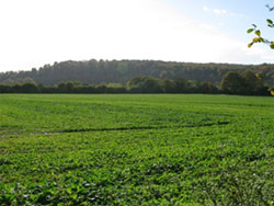
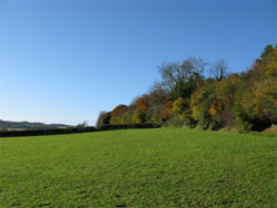
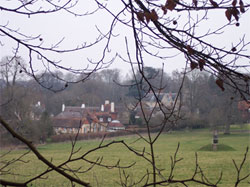
The Hanger north face as seen from Norton. 301
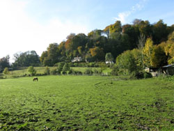
Note the village is not visible from Norton.
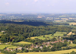
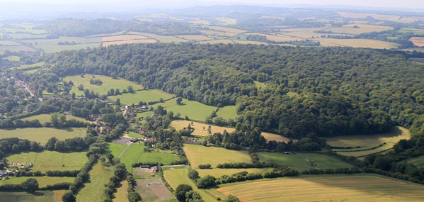
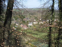
The village and the north face seen from the air, (026).
Key Characteristics have already been defined within the EHDC and SDNP Landscape Character Assessments for the whole area, and in summary are:
- A dramatic steep east-facing chalk escarpment, much of it clothed by hanger woodland to produce a soft irregular texture that masks the slope profile.
(In the case of the Selborne Hanger it is dramatic, rising 85 metres and all of it is clothed by hanging woodland).
- The scarp is dominant in views from the lowland with prominent landform features along the crest, seen against a backdrop of open sky.
(The Hanger woodland is mostly quite dense, and only in wintertime is the landform crest visible. Gaps created by storm damage over 20 years ago are now mostly filled).
- Remarkably consistent in height throughout its length as a result of the lithological uniformity of the chalk bedrock.
- Clothed in ancient beech dominated hanger woodlands which are of particular visual, historic and ecological interest. International biodiversity value represented by the East Hampshire Hangers SAC.
(Selborne Common is undergoing a major programme to restore its wood-pasture and chalk grassland habitats. The reintroduction of livestock and grazing and the re-establishment of traditional tree and woodland management (pollarding and coppicing) is at an early stage and aims to maintain the ancient ecological and landscape character of this surviving area of common land. . This is under the management of the National Trust).
- Deeply sunken ancient lanes and tracks cut the escarpment and link the lower land to the chalk uplands. (Local examples are Galley Hill Lane, Green Lane, Northfield Lane beyond Gracious Street and Kingsfield Lane which now function as modern vehicular routes while other ancient routes can be seen on the Hanger. These are still used by walkers but their sunken character results from centuries of use for transporting materials such as wood and chalk down the slope to the village. Commoners, driving their livestock up and down these tracks from time immemorial had also, without doubt contributed significantly to their deepening).
- Communication routes climb the scarp in coombes, for example Galley Hill Lane.
- At the foot of the scarp where the slopes are less steep, the land is ploughed for crops – here the open fields contrast with the well wooded scarp face.
(Most fields at the foot of the scarp are no longer ploughed and have become pasture where sheep, cattle and increasingly horses, graze. Some of this former arable land has developed and is developing into important species rich grassland – this is the result of management which, by chance or design, has avoided the use of chemical inputs and has adopted appropriate grazing regimes and scrub control. One field to the south side of the scarp, Westcroft, is ploughed).
- A number of small isolated chalk pits associated with the former agricultural lime burning industry are visible on the scarp, although many are masked by vegetation.
(On the steepest slopes, especially at the foot, there are several dozen chalk and marl pit sites. Some pits have merged to form larger and linear excavations).
- Panoramic views – the climb through dense woodland builds a sense of anticipation for the views from the open summits.
(Selborne Hanger offers extensive views to the north and east, including Blackdown, Haslemere, approximately 20km distant. Box Hill along the North Downs at around 40kms is also visible and it is possible to see the South Downs above Worthing at about the same distance).
- Strong associations with the naturalist Gilbert White including the route of the famous Zig Zag path at the Wakes, Selborne. The dramatic landscape has been a source of artistic and literary inspiration.
(Gilbert Whites’ A Natural History of Selborne, published in 1789, was one of the early pioneering studies in natural history, and within Selborne has spawned a mini-industry, with tourists, and students visiting the museum and field study centre).
3.1.1 LOCAL DETAIL OF THE SELBORNE SCARP (5c)
The Selborne Scarp is an exclusively east-facing scarp in East Hampshire: there are others, Noar Hill, and Hawkley Hangers, Oakshott and Wheatham Hills, forming the edge of the Hampshire Downs. Selborne Hanger is extremely well wooded throughout its length. The steep and in places precipitous landform of the Hanger, originally at the junction of the Chalk and the Upper Greensand, is formed by the erosion and undercutting of the chalk mass, revealing bands of Middle and Lower Chalk, the latter becoming more calcareous where it steepens.
The geological processes that gave rise to Hanger escarpment extend over millennia. The chalk itself was laid down under marine conditions and is said to be made of billions of shells and skeletal fragments from micro-organisms that lived in an Upper Cretaceous sea. During the Tertiary period (65 to 2 million years) the chalk was uplifted by the tectonic forces into an anticline, (upward folded). One has to imagine when standing at the top of the Hanger looking eastwards that there was a massive dome of chalk rising up to 1000m and extending across Surrey, Sussex and Kent and falling away to the east near Artois in the Pas de Calais. The top of the dome has been eroded and weathered away over 50 million years. This weathering has cut down through the Chalk and older layers below to expose the Upper Greensand, Gault, and Lower Greensand, etc.
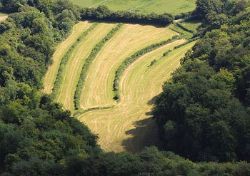
The arrow head scarp pointing west. 114
The scarp is imperceptibly moving westwards, as erosion of the adjacent softer beds to the east undermines the chalk scarp. The erosion is hard to estimate, (one centimetre per year average has been mentioned), but there have been accelerated erosion points due to uprooted trees and collateral storm damage. The steep contours mean that the scarp faces have never been cultivated, but there is evidence of small scale chalk quarrying on some of the less steep surfaces.
THE HANGER NORTH FACE. Character Area 5c-1
When approached from the north the Hanger presents a very uniform, densely contoured wall of high density woodland, mostly of mature beech, rising precipitously in places, from 125 to 210 metres above sea level. The Hanger appears to have a closed-canopy high-forest structure although in reality the beech woodland has reached a stage of advanced maturity and is in a state of transition where a new generation of naturally regenerated trees are poised to fill gaps in the canopy. Storms, drought and other natural processes are the principal factors currently causing the numerous gaps in the woodland canopy, although the National Trust does undertake some limited felling and tree management work on the Hanger where trees are judged to be a hazard for visitors. Woodland management back in the 1940s cleared several wedge-shaped coups that are still visible along the Hanger.
These have now regenerated with a range of species including ash, sycamore and field maple, perhaps to the disappointment of the foresters of the time who desired and expected beech to become dominant. Where the beech woodland has been allowed to grow on to maturity, it is usually accompanied by a healthy ‘under-storey’ of young beech which regenerated naturally several decades ago. Some sections of the Hanger are turning to Yew or Holly which can occur as another version of natural woodland succession on these soils. Seen from above, the scarp is arrow headed, (743332) with the easternmost point being the closest to the B3006 road. From the arrow’s point the steepest face runs north-westerly for 1km and this is the steepest external face of the scarp, with a very consistent height over 200m above sea level.
At the end of the straight stretch, the hill terminates in a southerly U-turn as Coneycroft Bottom an interesting claw-like steep sided valley that cuts back, around and into the hill. This encloses interesting fields and leaves a steep sided ridge spur at the back north western edge, a mirror image of the valley below. The main part of the village lies almost parallel to this north face, and access to the grazing lands of Selborne Common used to be via paths and tracks that were cut up the steep slope.
A mature beech above Love Lane
LoveLane FP13, (734338 to 743332) is a path that provides access to these climbing paths: it runs right along the base of the north face scarp, from Wood Lane in the north to the Zig Zag path in the east, which is just 100m or so short of the eastern-most point of the Hanger. Love Lane can be easily accessed in the village centre by the un-named track behind The Selborne Arms (FP10b) that leads along the eastern extremity of The Wakes Park. (Formerly this was via the Walk, a path through the woodland strip, known as the Piddle, within the Wakes, from the car park to the foot of the Zig Zag that was open until about 20 years ago). Love Lane footpath follows the route of an ancient right of way which allowed the commoners to transport wood from the common to the village.
Today it is a popular route used by both the village and visiting walkers: there are many signs of wear and tear due to heavy use. At the eastern end, the path climbs slightly and gently, giving good views of the Wakes Park, the Wakes Museum and a variety of village buildings and rooflines along Gracious Street and around the Plestor (including the Church). In the Park itself a few old parkland trees including maple, lime, beech, oak and ash remain as prominent landscape features, along with a variety of younger trees planted singly and in a small group as replacements The older veteran trees in this area are important as habitat for a variety of wildlife that require mature open-grown trees and deadwood at various stages of decay: (ref. various publications/ guides and projects set up by the Ancient Tree Forum, The Woodland Trust, The National Trust etc.)
The start of Love Lane at the base of the Zig Zag. 854
The Park was clearly divided into arable strips in earlier times, indicated by a series of lynchets parallel with, and stepping away from the Hanger. There are several sarsen stones (similar to the Wishing Stone at the top of the Zig Zag), marking the corner/boundary of one of the strips closest to the Hanger. Further west there are a few old ash trees, thought to have been markers or the remnants of hedges.
On the north side of the path the Park is well fenced but on the south side the Hanger rises very steeply and forms a natural path boundary. The Hanger woodland extends right to the base of the slope and as noted above many of the beech trees are in a state of advanced maturity; several have fallen or collapsed over recent decades.
After the western end of the Park, a stile leads into the Ewell the field adjacent to the Park. There is a footpath that leads across the field to Gracious Street, also heavily used, often as part of a circular route, (Selborne Arms – Love Lane – The Ewell – Gracious Street – High Street) which is comparatively level and allows walkers to stay close to the village. Love Lane continues along the base of the Hanger with views to the north across the former common fields, to the settlement area in Gracious Street.
These common fields had strips running at a right angle into the base of the slope which became hop fields at the turn of the 19th C but are now pasture used for sheep grazing. This part of Love Lane is used less than the eastern end; the boundary, is a mixed hedge as it moves away from the field. At this point it rises through undulating woodland, steeply in places.
There are many remains of old chalk pits at the foot of the escarpment and depressions in the boundary where chalk was carried across the fields after cropping harvest or when fallow. On the path itself the undergrowth is encroaching because of less use although it is still a popular part of the local footpath network. At this end on the Hanger above, there are noticeably larger gaps in the woodland due to the loss of groups of trees in the storms of 1987 and 1990, but vigorous new growth is well under way.
The Zig Zag Path, FP10b (741333), is the most direct and best known path up to Selborne Common, and can also be directly accessed from three paths, Love Lane (FP13), The Walk (FP10b), off The Street in the village Centre, and by FP18 that cuts across the Punfle. It is very well used by locals, walkers and tourists.
Looking down the Zig Zag. 018/2 and The Wishing Stone. 864
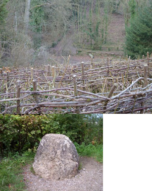
This was constructed under the direction of Gilbert White and his brother, and completed in 1756, as an all-weather access to the common; most other paths were, and still are, very muddy and slippery in winter time. Although beyond the boundary of Whites property, the path was cut, in effect, as a feature of a landscape garden that extended out from the Wakes. Zigzags were typical in the designed landscape of the eighteenth century, for example Stourhead, along with ha-has, vistas, heritages etc. The Zig Zag consists of a steeply cut gravelled path with 28 sharp bends, rising approximately 80 metres. At the top is a Wishing Stone, described by Gilbert White as the ‘obelisk’. This has been roughly hewn from a block of sarsen stone which occasionally occurs across the local area as a superficial deposit.
These sarsens are flint and quarzitic sands naturally bonded together with silcrete, a superficial deposit believed to be the remains of weathered tertiary deposits that were covering the chalk or from the layers of the chalk itself.
Each Zig Zag section is hedged with laid hazel or blackthorn, interwoven with brambles.
The steep banks have a diverse array of plants but dominant are the Harts Tongue and other ferns. Because the path provides a clearing in the wooded slope, it has become a very popular viewing platform with a new view appearing on the horizon at almost every turn. Views directly over the greensand terrace to Oakhanger and much further in the north open up progressively, as far as the North Downs. At the top a short path leads on to the Common.
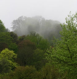
Mist rising from the Zig Zag Path, seen from Barnfield. 4190
The Zig Zag is cut through dense mature woodland, mostly beech, and to the sides blackthorn is being encouraged as part of the campaign to increase and revive the presence of the rare Brown Hairstreak butterfly that breeds exclusively on the top branches. The popularity of the path with tourists and walkers does cause erosion and regular maintenance is needed. Additionally some large adjacent trees have recently been reduced in height to meet safety concerns and this has been detrimental to the whole appearance of the path. It is hoped they will regenerate.
One consequence of cutting the path is to create a very localised microclimate.
On damp showery days evaporation causes cloud to rise up the hillside in the gully, and this is best viewed from the side in Barnfield to the south.
The views from the Zig Zag are much improved since the great storm in 1987 and with subsequent tree management it has become more panoramic.
Prior to the storm tall mature trees restricted views.
Today the views to the east are probably the best they have been for over a century. Other views come and go over the decades as trees die or are blown over by storms to be replaced by a new generation of young naturally regenerated trees that form an under storey poised to replace the older woodland.
Long standing plans to recreate a 90 degree panorama from the top of the Zig Zag, similar to that enjoyed in White’s time, were abandoned after planning permission was granted a few years ago, (much to the disappointment of most of the community), for a 5m upward extension to a previously discreet bungalow adjacent to the view point. This building is now being screened to reduce its intrusion on this focal point for visitors; an iconic Selborne place along the Hangers.
The newly planted evergreen trees, whilst necessary to screen the building, thwart attempts to create a view that would embrace the western weald from the North Downs to the north-east around to the South Downs looking south.
The start of the Bostal path at the base of the Zig Zag. 882
The Bostal Path (741333 to 736333), also constructed at White’s initiative in 1780, starts close to the bottom of the Zig-Zag but rather than rising almost vertically, it gently rises along the north face of the Hanger under the cathedral-like very high beech trees.
This is a beautiful and tranquil path that meets the Wadden Lane path at the most spectacular elevated viewing point for the village itself with the Church at the centre. The main view point from the top of the Bostal is a little more restricted as the crowns of mature beech trees have continued to expand into the gap down the hanger slope. A seat is provided. Behind the viewing area is the Wadden, now a wooded area.
Wadden Lane, (734336 to 741332), despite its name, is a path that runs the full length along the top of the Hanger ridge: it takes its name from the Wadden, a flattish area at the top of the hanger that was a cultivated open field until 1900. At the western end is a hub of five paths that join Wood Lane, the Hanger access from Gracious Street. At this point Wadden Lane was an ancient sunken lane, now a marked footpath, eroded by very heavy use. An old chalk pit is surrounded by many very old trees, again mostly beech, as is the full length of the path. There are three visible sites of interest: (1) signs of a prehistoric boundary, lower down above Love Lane, (2) evidence of three banks, one caused by ploughing, one bordering a sunken lane and one bordering the new path, and (3) an old valley, or “slider” that was used as both a route down the hillside and for moving lumber. At the eastern end Wadden Lane joins up with the top of the Zig Zag.
The Scrubbs with Barnfield below and cottages on Plum Fell Lane. 894
THE HANGER SOUTH FACE (Character Area 5c-2.)
The point of our arrowhead is quite blunt because the face of the scarp has been eroded, both naturally, by the abrupt change of orientation and by significant human intervention. The precipitous and curving section of the hanger woodland from the Zig Zag south around the point is called The Scrubbs, (742332). It is well covered in mainly beech trees, some copper, but there is evidence of significant storm damage with some fallen tree trunks pointing vertically down the slope. Further along there is a concentration of Yew. The Scrubbs turns south west and reduces in height as it does so. From there, the south face heads linearly south-westerly for a distance of 1.5km.
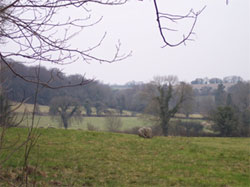
The fields on the south side of the Hanger are a continuation of the downland slope. 896
The south face contours are much less steep than those of the north face, and the section closest to the village provided a relatively easy access to the Common by a track, now Plum Fell Lane, running from the village centre under the Scrubbs and on up to four fields that were carved from the Scrubbs for the first 500m of the south facing hanger slope. These fields, Kite’s Acre, Rye Field, Starve Acre, and Lawn Acre were initially cultivated, pushing up 200m into the Common area. The latter two show ancient field patterns that are possibly Roman in origin. This section of the Hanger is the only part to suffer the encroachment of human habitation. The first four houses were built on Plum Fell Lane (a corruption of Punfle Lane), immediately under the Scrubbs, and consequently the Chalk was excavated to fit the buildings into the hillside and provide garden space and even a tennis court. This has altered the lower reaches of the Scrubbs and eliminated much of the original woodland. All these four buildings predate the 1842 Tithe map: this also shows the steep footpath that leaves the lane between the houses and climbs diagonally across the Scrubbs, eventually arriving at the top of the Zig Zag from the south side. Subsequently much damage was caused to the landscape by lax 20th century planning allowing four large additional houses to be built on the fields cut into the Hanger with the highest on Kite’s Acre, sitting just 10 metres below the hanger’s highest contour. Approaching Selborne from the south, these four houses are the first visible signs of habitation and, for many, compromise the view and the purity of the Hanger, particularly in winter.
The land surrounding these private dwellings is mostly garden space but two small fields remain as natural grassland, and are leased and managed by the National Trust, with the aim of restoring their full original biodiversity.
Because the surrounding chalk fields are relatively high compared to those at the foot of the north face, 175m at the southern edge of the wooded edge of the Common, (vs. 125m in the north), the contrast is less dramatic.
Today there are far fewer older trees, and the history of use indicates the reason. The Common was grazing land, and the southern periphery was open land unlike today, but efforts are underway to restore this to grazing in pockets by scrub clearance. The land was worked because the contours allowed it. There have always been fewer trees on the south face than on the north of the hanger, evidenced by an engraving in White’s book showing the southern half with very few trees in 1776. Along the full length of the base of the hanger is a classic bank and ditch, still very evident today, with a hedge around 100 years old consisting of at least five species at intervals of 0.5m to 1m.
The whole of the Hanger and Selborne Common is owned and managed by the National Trust and currently there is continuous restoration work being carried out, clearing grazing areas, reducing scrub, restoring hazel coppices, and maintaining wildlife natural habitats.
The south face has two old footpaths that lead up on to the Common. The first is a steep path that climbs rapidly up the face of the hanger across the Scrubbs, and is accessed between two of the early houses on Plum Fell Lane: it leads to the top of the Zig Zag. The second (path 17) is further along a steep part of Plum Fell Lane, then branches along the base of the hanger through one of the old incursive fields, emerging along the top edge of the Kings field, crossing the bank and ditch into the lower reaches of the Common on Sheep Down, eventually meeting other paths at the Newton Valence end of the Common.
At the far south-western end of the hanger, the bank and ditch give way to an area of cleared land that is an extension of Westcroft field pushing up into the Common land: this is approximately 200m long and runs 150m up the slope: currently left uncultivated and wild.
THE BASE OF THE HANGER. (Character Area – 5c 3).
The 1842 Tithe map shows the Hanger base surrounded by no fewer than twenty two fields that distanced the village settlement area by 125 to 300m. The only dwellings related to the hanger were the four small units on Plum Fell Lane, (originally Punfle Lane). Today this cordon of fields is almost completely intact (as the aerial photo shows above) providing the rare opportunity to view the hanger from all vantage points. Modern boundary changes however have consolidated the number of fields to fifteen with some of the old field names lost from use. These fields are extremely important to the Hanger landscape and to the village. They all stretch from the Hanger out to the lanes, roads, gardens and houses of the settlement area: they provide the continuous vista of the Hanger as it has been for centuries, and they must be preserved.
There is a perceptual character difference between the fields under the north and south faces of the hanger. In the north, the fields between the base of the Hanger and the settlement area, although down sloping, are generally flatter and occupy the Lower Chalk bench below the foot of the escarpment. Further west, towards the back of the Hanger, the fields are true down land.
To the south, the fields, at higher altitude, are a continuation of the Sheep Down slope off the Hanger, and as the side of a dry valley, are described as Downland Middle Chalk Mosaic, but as the field cordon as a whole is the vital Hanger viewing platform, the group should be considered a single entity. The field cordon descriptions start in the extreme northwest and run round to the extreme southwest, but for detail on the southern side please refer to section 3c.
Peak Common Field (also called Great Peak) and Dell Field. (732338) This is the very northern tip of the Hanger at the western end, and it has the most interesting field structure. Peak Common Field is a small medieval open field with a complex of strips and with the hedgerows intact. (Where hedges now mark the boundaries between the strips, sizeable lynchets are very evident along the strip boundaries, the result of centuries of cultivation). The whole field is now a pasture.
Peak Common Field 009
It is shaped as a wedge into the small valley between the Snap Grove, the outermost woodland spur and the almost circular Coneycroft Hill. The inner continuation of the Peak valley curves back south easterly to a narrow point, and this is an old field called Dell Field situated at Coneycroft Bottom.
This is a particularly tranquil place, long, and narrowing to a point with steep beech woods on either side. It has been grazed for the past fifteen years, and it is showing the benefits. Over the last two decades the field management, grazing and haymaking, has been aimed at improving the grassland diversity. A recent count produced over 100 spotted orchids and the numbers of cowslips are increasing yearly. It is permanently damp and therefore can be regarded as a meadow. At the top end are signs of a modest dam.
Fishers Field (735338) along with Peak Common Field, is now a part of the Coneycroft House small estate, (originating from 1750), named after the part of the Hanger that towers over it. A long narrow strip, it incorporates the spring at the western end of an ancient stew pond owned originally by the Selborne Priory, (1233 to 1484). Today the pond is an attractive water feature, in open pasture that has mown paths and parkland feature trees, including Walnut, Corsican Pine, Hornbeam and Lime. The outflow joins the Seale Stream at the junction of Gracious Street and Nine Acre Lane. The field runs parallel to Gracious Street for its full length, and is also visible from Wood Lane, the easiest access on to the common from this side.
Hill Field (735336) is bordered by the Love Lane path on both the south and west sides, and by Wood Lane to the north. It is the first of a succession of fields that sit under the hanger and separate it from the dwellings in Gracious Street and eventually The Street. There are good views across Hill Field from Wood Lane, across to The Wakes, The Park and Bakers Hill. Hill Field is Chalk at the southern end but transitions to Greensand at the north end. There is a significant lynchet along the eastern boundary with Little Peak Field caused by centuries of ploughing. Hops were grown until the mid-1900s, but now it is grazing land for sheep.
Little Peak Common Field (736336) the strip adjacent to Hill Field on the eastern side has similar characteristics, bordered on the south by Love Lane and by Wood Lane in the north. Like Hill Field, the north side of the field is Greensand based. The Chalk at the southern end is still deep, witnessed by the pits that have been dug over the centuries on the Hanger side of Love Lane. The depressions in the path to the field boundary are evidence of the removed chalk being transported across Little Peak. This was also a hop field, now used for sheep grazing.
The strip of fields at the base of the north side of the Hanger, from Dell to the Wakes Park. 123
Asletts Meadow (737336) is a small strip field east of Little Peak, again bordered by Love Lane in the south. To the north the boundary is with the gardens of the cottages along the south side of Gracious Street. It is mostly used for sheep grazing. There is no evidence of Greensand in this field.
A corner of the Ewell. 889
The Ewell (738335) (From the Old English Ywhulle ) is next along; a large field of 1.5Ha , south west of Gracious Street and stretching uphill to Love Lane at the Hanger base. It is adjacent to The Wakes Park of which it is an integral part. Until recently this has been under the same stewardship management as the Park, but a few years ago the lower two-thirds of the field (adjacent to Gracious Street) have been taken out of stewardship to provide an occasional car park for fund raising events at the museum. The lower section of this pasture field, which has a tendency to become boggy, is being invaded by a dense growth of blackthorn which supports brown hairstreak butterflies. Orchids have been found in the section beneath the hanger.
It is pasture and used for both sheep and cattle grazing with part time duty as The Wakes overflow car park. The boundaries are a mixture of fences and hedges with fencing, and drainage streams run down some lines of the old farm strips that were in use until the 1950s, still with lynchets in evidence. As with all of these fields, there are excellent views of the Hanger. The size of The Ewell combined with the adjacent fields offers attractive long views. This space contributes hugely to the character of the village. In the top north east corner is a high bank remnant of a former division between fields. There is a track joining the field gate at the right angle bend in Gracious Street (738336) and is an to the entrance to the park: this is a very old route mentioned by Gilbert White in his journals and gives access to what was then his Ewell field (now part of the Park). A bench provided by local residents next to the upper section of this track gives excellent views of the Hanger across Little Peak and Hill fields adjacent to the north.
The southern boundary consists of a very old hedge (judged by the number of species present) with hawthorn, dog roses and Lime trees. The hedge has been laid many times. The Eastern edge of the field has a hedge of mixed species perched on the side of a steep bank, predominantly hazel but with a line of blackthorn along the inner edge and ash trees as standards. The northern boundary is a gappy hedge of hawthorn, with some taller hawthorn trees. There is a public footpath just south of the very old cottage called Wheelwrights which is adjacent to part of the northern boundary. The footpath descends steeply down a muddy bank to the quiet hollow country lane of Gracious Street. Formerly this field was divided into separate strip fields, their long boundaries at right angles to the hanger (cf the park, where fields were parallel to the hanger) of one acre each: by 1842 (tythe map) there were three fields here of varying sizes. The whole field was once part of the Ewell common field of arable strips which included the neighbouring Wakes Park.
This has a similar feel to the Park, although as it is smaller is much more of an historic pasture field of great importance to the village, but not forming part of Gilbert White’s historic Landscape. It is a remnant of an historic village landscape when each house was a small farmstead separated by expanses of pasture and arable. The field is quiet, and quite well insulated from the noise of the main road (B3006)
In the past this field has been arable and in the early 20th Century there was a fruit cage on the southern section. The flora does not seem as diverse as the neighbouring park and the grass crop does not grow as strongly here as in that field. It is an essential and historic field in the landscape of Selborne, and would be endangered if there were to be any change away from the charitable trust managing the Wakes Museum.
The Wakes Park. 888
The Wakes Park (740335) is a major and important part of the cordon of fields that surround the Hanger. It is a large (8Ha) pasture field with distinct terraces as it rises to Love Lane and the Hanger to the west. The eastern border is The Wakes (Gilbert White’s House Museum) garden. To the north it is bounded by Gracious
Street and the Ewell. The Wakes former old stables are now a private house and garden and they form part of the northern boundary on Gracious Street. To the south is a strip of trees called The Piddle, and a large old tythe barn, The Field Study Centre used as an education centre. The park itself is dotted with lime, maple, hawthorn and beech trees, with single specimen oak and hornbeams and a clump of field maples in the centre (planted 1995 as part of the restoration scheme) The south eastern boundary of The Park is a tree lined and a fenced lane, (once called the Walk, when inside the Wakes), connecting the High Street to the base of the Hanger at the start of the Zig Zag path. This lane is very heavily used, by dog walkers, walkers, and tourists; litter is often found along this path.
Together with the wooded scarp slope of Selborne hanger the park forms a beautiful backdrop for the historic Gilbert White garden, which contains a 4m high cut out ‘statue’ of Hercules, and a mound of almost 2m topped, with a seat made from a large barrel (Gilbert White’s ‘Wine Pipe’) erected as part of the landscape restoration scheme by Wilkie 1993 and implemented in 1995. These features are designed to be viewed from the Wakes garden as part of White’s re-constructed garden. A brick path leading from the garden to a large old beech tree in the centre of the park still exists, although now covered with grass and bisected by a tall mixed hedge of maple, hazel and hawthorn planted 1995. The park is open to museum visitors during most days of the year, and includes a close mown path through the longer pasture grass as part of a walk around the garden. From the beginning of the year until July the grass is left to grow long, and a hay crop is taken. It is then grazed by cattle or sheep until the winter. Since 1993 in has been under the Stewardship scheme, no herbicides or fertilizers having been used, and the regime of hay-making and grazing being followed. The range of wild flowers has been steadily increasing, and various orchids have been found at times, particularly towards the base of the Hanger.
The Park was originally arable land called the Ewell, the name now given to most northerly neighbouring field after division, (see separate description). It was at least partially enclosed by the 17th century into 13 or more fields, most of which were arable, a few pasture, but it became a park in early 19th century, retaining a few old maples, hawthorns and a large beech as remnants of the earlier hedgerows.
Many of these are very old and likely to disappear. From the end of the 19thC until restoration in 1995 The Park included most of the small hill to the SE called Bakers Hill, but this is now incorporated in the garden. In the 1960’s part of south east corner was made into an overflow car park for the village.
Sarsen stones in the upper area of the Park. 885.
The park has a sense of great tranquillity, which it transmits to the Wakes garden and is greatly influenced by the steep wooded slopes of the hanger behind. In winter a blue or grey mist often hangs over the field, sometimes giving an eerie ‘layered’ effect. The main road (B3006) can be heard from the park, but is sufficiently distant to only give muffled interference during peak periods. Otherwise there is a sense of stillness and calm, and during haymaking the smell of cut grass is delightful. The many colours of the wild flowers and grasses change through the year: in early spring the fields are coloured yellow with dandelions, later the same yellow comes from the buttercups (just as recorded by Gilbert White over 250 years ago): after haymaking the grass is dotted with red clover.
There is a narrow strip of woodland at the extreme eastern end of the park, called The Piddle. This borders the straight footpath (The Walk), leading from the village car park to the base of Gilbert White’s Zig Zag path.
This is an interesting strip of woodland containing large Beech trees maybe 150 years old, but also with yew trees and holly bushes. Little ground cover under beeches, but elsewhere there is a cover of ivy: there are patches of Abraham Isaac and Jacob (Trachystemon orientalis) and a few low bushes of Butcher’s Broom (Ruscus aculeatus) at the eastern end. In the centre section there is much Sweet Woodruff (Galium odoratum). At the western end there is Dogs Mercury, (Mercurialis perennis). The beech is dominant and the under-storey is holly and yew with a further intermediate layer of snowberry. In places there is dense undergrowth, particularly of snowberry, and on the southwest edge a dense growth of elm, maple, ash sycamore and wild rose has grown up over the fence of sheep netting and plain wire. At the car park end, beyond the Wakes Field Study Centre, the strip narrows to a few metres and there is a large sycamore tree.
In the northwest, (park) side are two conglomerate or sarsen stones which marked the position of an ‘L’ shaped piece of land, (see Deeds of the Wakes).
 The entire strip is fenced by sheep fencing on the north and south, post and rail and the western end, and by chain link fencing at the eastern end. This is a dark, shady place with dense vegetation in places, and interesting bare patches under the large beech trees, which change and become lighter in the winter, contrasting with the dark places under the yew trees at that season. A secret, private place with a sense of wilderness, although narrow, and next to frequently used footpaths. A number of old trees have fallen or lost boughs, and there are piles of old rotting branches, good habitats for wildlife.
This strip of woodland forms a sort of very large hedge between two sections of the village.
There is some regeneration of beech and other trees, and the only threat to its character would appear to be the growth of Sycamore. In the 18th century this was arable land (possibly Gilbert White’s ‘Little Bean field just short of the Pound Field’ (The Punfle), where White’s Tortoise Timothy was re-discovered after escaping from his garden next to the Wakes: this was a long walk for a tortoise. By the 1870’s this was heavily wooded with both deciduous and evergreen trees (probably Beech & Yew. (1870 OS Map) and by this time a footpath appears running straight through the trees. By 1910 this footpath was more winding (no doubt to avoid the increasing canopies of the trees) but by this time also the alternative straight path on the southern edge of the area leading to the zigzag was in use.
The winding path continued until the 1980’s (even though the area had been fenced off, some residents continued to use it) but by the 1990’s the winding path fell into disuse. The Trachystemon orientalis is thought to have been remnants of a garden planting dug out and thrown into the woodland when the over-flow car park was created in the 1960’s. (See Flora of Hampshire, Brewis, Bowman & Rose 1996) and this possibly applies to the snowberry and Butcher’s Broom.
The park is at present maintained by a small number of Gilbert White museum staff and volunteers including a local farmer, all of whom are keen to conserve the beauty of the area and to improve the bio-diversity of the site. The Gilbert White Museum is a private charitable trust, and is in need of support to maintain its status in a difficult economic climate at present. The site and its history need to be preserved and protected from development. There is a covenant over the site held by the National Trust to control inappropriate changes, and the area is within the conservation area.
The Punfle, from The Scrubbs. 543
The Punfle (742334) on the south side of the “New Walk”, has had a succession of names, and has been recorded as both Pound Field and Pond Field, and today is also known as Great Punfle, and Punfle being a corruption of Pond Field. Along the top edge running south from the base of the Zig Zag is a short, fenced footpath skirting the bottom of the Scrubbs, through a narrow strip of woodland, eventually meeting Plum Fell Lane at the south end. (Plum Fell Lane is itself an erroneous corruption of Punfle by some bygone officialdom). The field is privately owned with the grassed part used for horse grazing.
This gives way to a private garden, the first in a sequence on the west side of the lane. Originally the lane was a track running diagonally south across the centre of the Punfle, but today in this section, it is a high hedged single lane road providing access to the dwellings further up the hill. This isolates the east side of the field that has mostly become garden space, for the modern houses at the start of the lane, but a residual field still exists and is being left as a wild meadow by the owner in an effort to increase the natural biodiversity. This field extends to the boundary with Barnfield. At this point Plum Fell Lane is an integral part of the busy Hangers Way walk. It continues along the top of Barnfield.
Barnfield looking toward The Scrubbs. The hedgerow is threatening the open view.146
Barnfield (743333) borders the eastern end of the Punfle, alongside the “garden” section and is separated by a mixed woodland boundary of hazel, ash, white poplar etc. Barnfield is also known as Under the Hill and it stretches from Plum Fell Lane under the Scrubbs eastward to the High Street, which is bordered by several historic dwellings with gardens stretching into the field area. Barnfield has a steep slope down from the lane, flattening towards the houses, possibly along the line where the Chalk gives way to the Greensand. The upper field is chalk marl and has a heavy clay soil.
It is used for recreational grazing of sheep and horses, but is not well drained at the lower levels and is difficult to maintain. There is evidence suggesting the existence of at least one medieval strip lynchet on the upper part of the slope running parallel to the lane. Across Barnfield there are excellent views of the hanger from the road, especially in autumn with the beech and copper beech contrasting with the density of the yew. There is a section of the lower field, the northeast corner, that has been fenced off with a mixed hedge planted, approximately ten years ago. The hedge is now a row of small trees, ash and hawthorn, and these interrupt and spoil the foreground view of what is grassland sweeping up to the base of the Hanger. This hedge was planted as part of a speculative and failed attempt to develop housing and should be removed to preserve the integrity of the view to the Hanger.
There is a pathway used by villagers for well over 30 years, across Barnfield, entering via a stile just off The Street in the driveway between Copper Beech House and Half House. The path follows a line across the northern edge of the field through a gate in a fence that sections off the northeast corner of the field, and on up to Plum Fell Lane, where the exit is over a second stile. This pathway is not a statutory right of way, but its continuous use for over 30 years indicates that it should be accorded this protection. Barnfield, like Burlands has been the subject of speculative attempts to develop housing, but in both cases local opinion has been strongly backed by planning inspectors: it is within the conservation area and outside the settlement boundary and is a precious village open space.
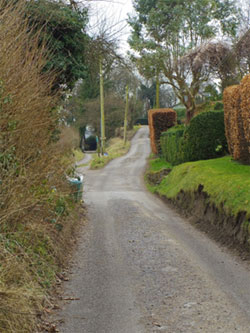
Looking south as Plum Fell Lane starts to climb the Scrubbs. 002 2013 03 01.
Plum Fell Lane (742335 to 740332) is a corruption of the old name Punfle Lane. (There is a sentiment in the village to restore the name to the original). It originates at the car park area in the village centre, at the junction with the access path to the Zig Zag, (FP10b). At this point it is the southern section of The Hangers Way in the village, following a very straight line south across the Great Punfle, and with high mature hedges on both sides. The Hangers Way branches off below Plum Fell Lane continuing between the Kings Field and Galley Hill fields. There are four 18thC cottages on Plum Fell Lane and these appear to have been cut into the Scrubbs hillside, with their garden spaces. In fact the angle of the scarp is extremely steep behind the cottages, and it seems likely that the chalk was cut in this area, and the cottages built upon the flat bed left after excavation. Above the Hangers Way, Plum Fell Lane rises away increasingly steeply above Barnfield.
Views across the field are compromised by an ugly collection of overhead cables that run along the lane. At the end of Barnfield the lane turns up, more steeply and south westerly, to follow the curve of the Scrubbs and Rye Field, meeting Adams Lane, rising from the east, then continuing to turn up into the Hanger to service the four houses built at the top. The surface of this road is not maintained in the upper area and is in a bad condition. Being so steep it is very difficult for vehicles to negotiate in bad weather. Where the lane turns sharply is the point at which the Hanger is closest to the B3006 road where it climbs through trees with fields below on the south side, including the remains of an abandoned orchard. There is a footpath (FP17) off to the south west skirting the southern edge of the Hanger, and from this point the road, now privately owned, climbs to the four houses on the south ridge of the Hanger. The overshadowing trees mean that many shade loving plants thrive, and there is a mix of ferns including the Harts Tongue alongside the road. Wild flower meadows (Rye Field and Starve Acre) are on the upper side of the road after it leaves the canopy of trees. From here there are long open views towards Noar Hill and Blackmoor.
Alongside Barnfield, the B3006 turns south, squeezing close to the hanger, and creating the narrowest point of the green cordon, with only 125m separating the road from the Scrubbs base. Proximity to the road has meant reduction of the cordon with housing both old and relatively new stretching along the road as far as Galley Hill Lane. Trumpeters, one of the historic village houses sits halfway up the hill, at the southern end of Barnfield with its own access to the road. (A recent excavation above Trumpeters into the hillside shows marl to a depth of 3m at this point).
Adams Lane (744332) The small area between the road and the Scrubbs is narrow, very steep and bisected by an old sunken pathway, a tree and scrub-lined tunnel, Adams Lane, running steeply uphill from the B3006 to Plum Fell Lane. There is Greensand in evidence here with a small area of malmstone about halfway up the slope, lining the sunken sides. At the top of Adams Lane is a recent redevelopment of an older house on a spur below Plum Fell Lane. Immediately after this point, both the road and the hanger turn away from each other and on the south face the open views return.
At the foot of the south face of the hanger are the fields, The Kings Field, and Westcroft: these are described in the Character Area 3c, Downland Mosaic.