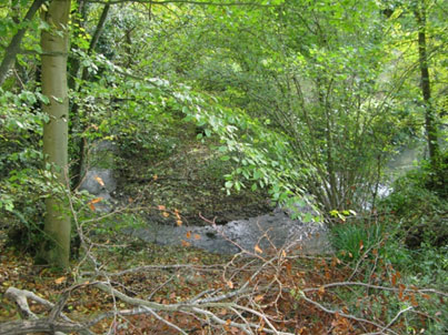
The EHDC Landscape Type mapping shows the eastern boundary further to the west than both the geological survey and our local observations. Hall Lane runs from Upper Farringdon to the B3006 north of the village at Norton Farm, and this can be used as a measuring line. The EHDC boundary runs west to east along Hall Lane as far as Fielders Farm, then turns southeast approximately 1km before cutting back south west to the rear spur point of the hanger. In practice, the down land chalk cuts Hall Lane 500m east at Frenchmare Copse, having taken a more northern line, then to the edge of the settlement area in Gracious Street, which it follows for 200m. Thereafter, the boundary encompasses the area under the hanger, tracking a line on the western side of the B3006.
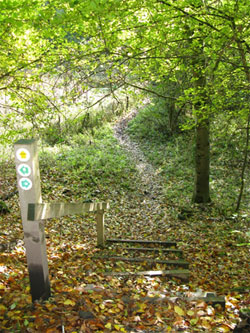
The sunken lane, recently cleared of scrub, is a footpath on the east side of the road, but only partly accessible in the sunken area.
(FP22 to Hartley Maudit, and FP24 to Wick Hill). 281
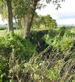
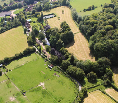
Norton. (739350) North of the village and to the east of Bush Down is Norton Farm, sitting within the northern parish boundary. Once a farmstead hamlet and, in Saxon times, larger than Selborne, it is today a farm complex. (Norton and Sotherington to the south of the village are assumed to imply their geographical location with respect to the village). Norton Farm is a commercial farm primarily concerned with food production, but has diversified by leasing outbuildings. Agricultural land classification is typically grade 3 or 4 on the terrace. The B3006 road now passes Norton in a north-south direction but the original sunken lane to Alton looped around the south of the farm turning north well to the east of the present day road.
Whithers (735345) is a large arable field to the immediate south of the farm complex, typically cropped with wheat. Around the perimeter of the field is a 6 metre wide grass margin which has been established for approximately ten years for the purpose of nature conservation. The margin provides tussocky grasses as a habitat for mice and voles which in turn support barn owls (and other birds of prey) which are known to be breeding on Norton Farm. The margin also acts as a buffer between the hedgerow and the cultivated arable field and neither fertilizer nor sprays are applied to the grass margin. There is an open aspect to the north with views to Holybourne Down in the far distance. To the west the landscape appears tree covered with Bush Down rising out of the trees. This is deceptively foreshortened as there are meadows behind the high hedges. Selborne Common can be seen to the southwest. The high hedgerow to the east contains hawthorn, hazel, blackthorn, field maple and elder with some large ancient oak trees. These oaks denote the fact that this is an ancient boundary between the Saxon manors of Norton and Selborne. The narrow footpath from the large open arable field leads south to Nine Acres in the direction of the village.
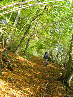
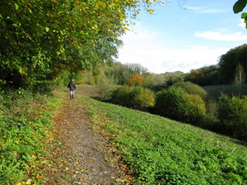
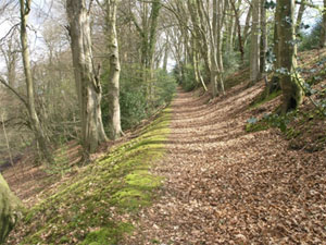
Nine Acres (738343) is a small farmstead located on a level open area of land. There are two detached dwellings plus outbuildings which are now mainly in equine use. There is a gravel surfaced yard area that drops into a sunken lane with exposed greensand rock in the steep sided banks. The trees have grown to form a green hollow tunnel. Travelling south west along the lane, the land slopes down gently. This lane was previously called The Old Coach Road and was a section of the main access into Selborne from the Alton direction until the road, now the B3006, was built in the mid-1800s. The lane has a tarmac surface with sections having been widened with a concrete strip next to the drainage gulley.
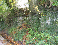
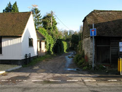
Typical malmstone banking (305) on the north side of Nine Acre Lane.
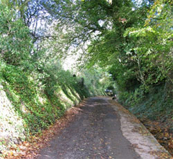
Nine Acre Lane, looking north. 306
During wet conditions, water pours down this lane as it drains off the adjacent fields. There are land drain outfalls visible at several points along the lane.
The trees in the overgrown hedge which flanks the lane are predominantly a mixture of ash, oak, hazel, holly and cherry. The roots of the larger trees are clearly visible in the banks of the lane and are a notable feature. The bank and boundary hedge, which is now overgrown into sizeable trees, are the main features noted above. They create the enclosed nature of the lane, giving a rather damp, dark and eerie atmosphere. The lane now only services the farmstead with two houses. There is minimal vehicular traffic, but it also links in to two footpaths and walkers use these fairly frequently. At the village end it descends eventually to the Grange Farm area (no longer a farm, since developed for housing) and Gracious Street.
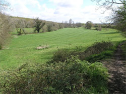
Redden Field. (744347) Named from The Ridden, meaning cleared. On the eastern side of the B3006, opposite Norton Farm and Nine Acres, is a large field gently sloping up towards Long Copse in the east, where the land drops precipitously by up to 40m. To the south it rises a little more steeply, cresting at the top edge of the Long Lythe, again dropping precipitously. The building of the road to Alton changed the field pattern considerably: there were once ten fields, now there is just one divided into two sections. The field’s elevated position has views to Selborne Hanger to the south-west and Noar Hill to the south. Goslings Croft is visible in the distance, but the village is hidden. The area appears undulating and is positioned on top of the greensand escarpment. The presence of trees disguises the steep hillside below the plateau. There is a good view of the Hanger landscape with a sense of the scale of those hills. These large arable fields are normally planted with cereal crops. A tall, 2m uncut hedgerow separates the two arable fields and then continues as a woodland edge. The hedgerow contains oaks and bracken indicating the greensand sub-strata. There are also spindle bushes in the boundary hedge. The woodland immediately adjacent to the southern edge of the arable land is the boundary of the Long Lythe with the tree-line following the top of the escarpment. The hedgerow and woodland edges are populated with farmland birds, with yellowhammers, chaffinches and bullfinches seen. The noise from the road makes this a less than tranquil spot: the sound of traffic becomes more apparent as the land rises, with traffic visible in the distance. Rooks and robins do compete however, and in autumn the colours are fresh and bright.
The northern end of Long Copse, hiding the steep bowl within. 356
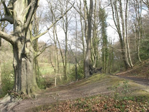
Long Copse (749344 to 750354) is a wooded greensand scarp dropping between 30 and 40 metres from the crest at the edge of Redden Field. The field has a wide headland acting as a protective buffer to the woodland, and is planted with several seed mixes aimed at providing nectar sources for insects in the summer months and seed for birds to feed on during the winter months. Long Copse has always been recorded as a coppice and remains so today. The woodland is being actively managed with coppicing and felling on a rotational basis. There is a range of ages of re-growth with some additional new planting of oaks and hazel in cleared areas. An abundance of woodland flowers emerge after the felling has taken place; species include Bluebell, Red and White Campion, Vetches. Brambles are quick to re-establish and these provide an ideal habitat for nesting birds and mammals as well as an important food source in the autumn.
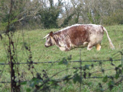
Where felling has taken place it is possible to look across the valley to Milking Hanger to the east: this has not been coppiced for a long time and provides an area of contrasting habitat. Coombe Wood is visible to the south east as are the ponds in the Great Mead valley, which is grazed mainly by horses but with a couple of family pet longhorn cattle for company.
Where woodland compartments have been worked, deer fencing has been erected to protect the re-growth and new planting. The woodland area of Long Copse is a SSSI which is recorded as being in an improving condition. This is a quiet, atmospheric place with birdsong and bright autumnal colours.
On the upper valley floor of Milking Hanger.249
Milking Hanger (750350) is the eastern face of the valley that faces Long Copse. This valley curves north to northeast below and around the upper fields of Wick Hill Farm with a closed end at the northern extremity. At the southern open end (originally known as Pond Piece), the valley floor is grass meadow land that links Milking Hanger to Long Copse and rises to the north. The hanger slope is very steep at this point but is hidden behind the mature trees growing on the escarpment. The improved pasture land is closely grazed by cattle and horses. Grasses, clover, buttercups, docks and thistles are evident. This lower part of the valley is sheltered and secluded land enclosed by the steep wooded hills to the west, north and east, opening out to further pasture land and lakes to the south. Several mature oaks are located within the pasture. Woodland and mature hedgerows enclose the pasture land with a relatively new hawthorn hedge having been planted.
Up into the hanger the ground is fairly level, with the steep hanger slope rising 20-30m sharply, but the steepness of the hill is disguised by the mature trees growing on this west facing scarp. Below is woodland meadow, open land interspersed with mature trees. Beech, Ash, Oak and Field Maple grow in an area of scrubby undergrowth (some brambles, nettles, long grasses and wild flowers). Bluebells in the spring.
The upper area of the valley has a level floor rising to steep greensand scarp to the east and north. A stream divides Milking Hanger from Long Copse, and this feeds the Great Mead Pond. Milking Hanger escarpment faces west and south.
Mature trees cover the valley and slopes of Milking Hanger; predominantly ash with a hazel under-storey. There are also some oaks, beech and sycamore and in one area (that appears on the 1842 tithe map to have been an open field) there is a poplar plantation. This is private woodland with no public access. There appears to be no recent active management of the woodland and there is a variety of ground cover plants including Dog’s Mercury, Soloman’s Seal, mosses and bracken. Fallen dead timber provides a good habitat for invertebrates. The north and eastern parts of Milking Hanger have very steep slopes that would make commercial timber extraction difficult. The valley floor is wet and boggy with rainwater run off to the small stream at the base of the slope.
There is stock fencing between the grazing land and woodland, otherwise none. Twittering birds, cooing pigeons and screech of a buzzard. Very quiet and secluded, dark and green in this part of the valley.
The northern edge of the woodland is buffered by a bridleway with grass and wild-flower margins. When walking along the top of the northern edge of the woodland, the woodland screen is so effective that there is no sense of the steep valley sides below.
The south slope of Wick Hill looking down to Wick Wood. The Hangers Way path passes through the meadow at the bottom. 252
Wick Hill (752352) is a Greensand hill to the north of the village, 170m high with several outstanding features. At the top is Wick Hill Farm, given over to pasture land mostly for equine use. The western slope is Milking Hanger, the side of the valley formed with the facing Long Copse. Milking Hanger is the most northerly of the greensand hangers within the parish and is wooded up to approximately 155m. From the top edge of the woodland, Wick Hill is open grassland, originally four fields called Long Field, at the lower level topped by Ten Acres, Nine Acres, and Hilly Field. The farm building complex sits at the highest level. The parish boundary runs south to the farm along the access track. The southern slopes of Wick Hill are mostly woodland, Coombe Wood and Wick Wood, but there is an area of pasture on the lower slope that separates the southern end of Milking Hanger from Long Copse. This comprises Plains, formerly a hop field, The Piece and Great Mead with the northernmost of the three ponds. In fact, only one pond is shown on the 1842 Tithe Map, the other two ponds are recent and controversial excavations of ancient bog land. The Hangers Way cuts through Wick Hill, arriving via The Long Lythe, through Great Mead along the north side of Coombe Wood, then across a field called Five Fields Mead, a very lumpy bumpy field that looks to have had many clay slippages. The Hangers Way (FP26 here), re-enters woodland at Wick Wood where it turns north en route to Candovers, King John’s Hill, and East Worldham.
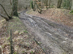
The condition of the track that carries the Hangers’ Way north is in a terribly damaged condition through irresponsible use of off road vehicles. (See BOAT FP67 below). Ruts have been carved so deep that even those vehicles cannot use the track, so they take to the woodland and have doubled or trebled the used width with untold damage to the woodland. Sadly, this seems to be true for much of this track down to Priory Farm south of Wick Wood.
Coombe Wood (752346) on the south slope of Wick Hill is an area approximately 500m long and reaches 300m up the slope. Dense, unmaintained privately owned woodland with a wide selection of mixed age trees, including Beech, many Silver Birch, Oak, ex-coppiced Hazel, Blackthorn, Hawthorn, Holly, and Ash, with Willow along the southern edge and even some wild gooseberries at the north east corner. The western boundary is with Great Mead field by the pond; it is fenced. The southern boundary is with Little Mead pond and the field extending along to Priory Farm, also fenced. The northern boundary coincides with the Hangers’ Way walk through the woodland, dividing Coombe Wood from the southern end of Milking Hanger; this is also fenced. At the end of the woodland, the path continues diagonally across an unstable field, due to clay slippage, possibly originally known as Five Fields Mead. This field has a stream running NE to SW down the central gully and it may be surface drainage. The eastern boundary is assumed to be immediately east of the BOAT FP67 that runs up between Coombe Wood and Wick Wood to Candovers, it is in fact a steep bank and drop. Southern access to the wood is along the Priory Farm path that runs west to east. The clay is very sticky even in dry-ish conditions and both this path and the Hangers’ Way are extremely muddy.
Views from the wood are interesting, and are as follows:
- South from the Priory Farm path across the Little Mead pond: look out for Kingfishers on summer evenings.
- West from the Hangers Way path: this can take in Long Copse, the ponds and along the Long Lythe to the Hanger.
- East from where the Hangers Way exits Coombe Wood, over the interesting lumpy clay slipped field below Wick Farm.
This is a good area for wildlife, with many Buzzards, Rooks, Jackdaws and Green Woodpeckers. The ponds attract Swans, Canada Geese, Coots, Moorhens, Mallards, Herons and seemingly thousands of frogs. This is a very tranquil area with the only noise intrusion from the buzzards and in spring, the frogs.
The woodland is decaying without any signs of manual intervention. The pathways are all in bad condition. The Hangers way, as it transitions Coombe Wood, is always muddy and difficult to navigate at all but the driest of times. The Priory Farm path through the southern part is equally muddy at the eastern end and at times hazardous, immediately before the east stile.
FP67 on a good day. Looking north with Coombe Wood on the right and Wick Wood on the left. 689
The BOAT (FP67) up the eastern side of Coombe Wood is sometimes impassable on foot due to the damage caused by off-road vehicles. This is particularly true just north of Coombe Wood on the Hangers’ Way section. There is extensive damage where vehicles leave the track because ruts are too deep, and this causes a wider area of damage. Debris is often left from damaged vehicles. Access needed for electricity cable maintenance must be very difficult at times. A linear clearing through both Coombe Wood and Wick Wood carries small pylons.
Wick Wood (755350) This area of woodland occupies most of the eastern slope of Wick Hill. Eventually the same stretch of woodland reaches Candovers and extends into Hartley Wood. The boundary of this survey cuts off at the parish boundary, running diagonally northwest to southeast through Wick Wood. Mixed age woodland but no ancient trees were identified in the area surveyed. There is little sign of maintenance but there is a permissible track for walkers, cutting into the depth of the woodland and looping up to Candovers.
In this section there are no views except from the southern edge over Priory Farm.
The western boundary is the damaged BOAT 67 running from Priory Farm to Candovers, carrying the Hangers’ Way path. This is sometimes impassable on foot in places, particularly north of Coombe Wood.
The entrance to Wick Wood from Great Mead on the south side. 686
The track has a bank on the east side which then drops away very steeply to a boggy area of woodland below. Halfway up the track there appear to be signs of an earlier track route, displaced east about 2 to 3m, and this runs for about 300m. If it is the earlier track, it may have long been in disuse as an oak over 100 years old sits in the middle. The southern boundary is to the field to the immediate north of Priory Farm (the field with the Monks Walk to Oakhanger).
Priory Farm (755345) is situated below Wick Wood, alongside the Oakhanger Stream on the historic site of the Selborne Priory. Nothing remains of the Priory, as the result of its closure in 1486 (for financial reasons and due to a lack of order, and before the Dissolution), but the farm has been established since the time of the Priory. The farm sits in a hollow/valley midway between Selborne and Oakhanger and the Via Canonorum (also called Monks Walk) runs between the villages, through the farm, which comprises mainly cattle and horse grazing in the adjacent fields. The farm has converted the old dairy into holiday let apartments. Access to the farm is via Priory Farm Lane that runs north off Honey Lane, past Rhode Hill Farm or on foot from the village by the Via Canonorum.
CENTRAL UPPER GREENSAND Character Area – 6a
North Central 6a, includes:, Newton Valence Lane, including Coneycroft, Gracious Street and Grange Farm; Goslings Croft, Kimbers, Church Meadow, The Lythes, Dorton, Sparrow Hanger and Huckers Lane.
Note: Road names can be confusing, especially when a single road transitions through 3 names in a short distance. This, according to traditional use is what happens to the road that leaves Selborne as Gracious Street, becomes Newton Valence Lane and then Northfields Lane.
Coneycroft (735339) marks the northern extreme edge of village settlement. This country house is set in extensive private parkland grounds. At this point, the lane, Newton Valence Lane rises gently to the west and falls away steeply towards the village and Gracious Street in the east. The house forms a long building line directly on the road, broken by recesses on the south of the lane.
Coneycroft, with Newton Valence Lane. The old Poor House, now 3 cottages is visible as a horseshoe shape. 021
The line of the road is marked by high mature hedgerows, punctuated by mature trees on both sides. Distant views are only found in breaks in the hedgerow and at the entrances to Coneycroft.
Main views are along the lane to west and east but are spoiled by the intrusion of overhead wires.
Along its length, the lane is well enclosed with high mature hedgerows either side and by overhanging mature trees. This location forms the transition between village and countryside and it is clear that this lane and its setting is little changed over the years. Traffic is very sparse, and the sounds are those of the countryside: birdsong and sheep were clearly heard and fresh mown hay the predominant smell. Past Coneycroft the lane descends to Grange Farm.
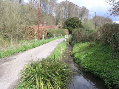
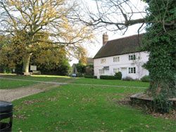
Grange Farm. (738339) Newton Valence Lane drops down past two cottages on the north side and reaches Gracious Street at Grange Farm, the former northern exit of the village and the only road to Alton. Today it is no longer a farm and the road’s northern extension leads only to a small farmstead at Nine Acres. The Grange Farm House remains an original and valued building. Other buildings have been well converted into housing and additional new ones created, using traditional brick and malmstone, blending well with the older housing of Gracious Street to create a coherent sense of place. This is a very old and important junction of roads and lanes, surrounded by mature and well defined trees. These are: the old sunken lane up to Nine Acres, showing steep banks of exposed greensand; Gracious Street turning off to the west up a gentle incline towards Coneycroft and Newton Valence, and south back to the village; Wood Lane on to the Hanger, and the now redeveloped Grange Farm yard. There is a sense that this must have been a long established meeting place. The banking is reduced when the road turns south and particularly interesting at this point is the old Thatched Barn at the edge of the old farmyard. The space is wide open, with sunken and hedged lanes radiating from it. The Seale stream meets the outflow from the Coneycroft Ponds here, so for much of the year there is the sound of running water. There are long views to the Hanger, looking both south and west: it is a popular part of the local walks, and perhaps enhanced by the recent introduction of a 20mph speed restriction.
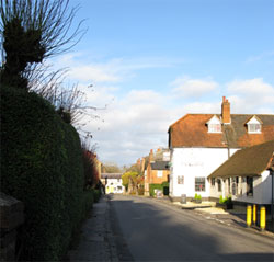
Gracious Street descending from the junction with the B3006. The Lane is dominated by the Hanger. 177
Gracious Street (740337 to 735339) was the old northern exit from the village via Grange Farm and Norton, to Alton. Another lane, ‘Northfield Lane/Hill’, branched off to the north east leading to Newton Valence: today this is the only through route for vehicles beyond Gracious Street. After the building of the ‘New Road’ (B3006) in 1846, Gracious Street has become a quiet residency , but it still serves as access to agricultural lands in the north via the various tracks and lanes that had been in use for centuries and it remains the main access to Newton Valence from the village.At the junction with Wood Lane is a collection of cottages with an interesting Horseshoe plan.
These were originally the Poor House, famously damaged in the 1830s during the Selborne riots.
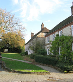
On the western side of Gracious Street is a string of old houses and cottages. Facing Grange Farm is Trimmings one of the 49 listed historic buildings in the village. This house is typical of many in Selborne, a thatched timber framed house with malmstone and brick infill construction, many possibly built with the material from the closed Priory. One house has replaced the original thatch with cedar shingles. At this point, Gracious Street is at its lowest elevation.
The Seale Stream runs in a culvert on the eastern side of the road before cutting east through Webbs Mead, where it has carved a steep valley in front of the village school. From here, it passes under the B3006 via Kimbers on its way to join up with the Wellhead Stream at Dorton in the Lythes to the east.
The school recreation field rises away on the east side of the road, forming the south side of the stream valley, with a small pull-in for cars. Across the road on the western side, some of the older cottages in the village sit directly fronting the road with back gardens rising up to the fields and Hanger beyond. Other old cottages are set back from the road with hedges fronting the road. On the east side more modern housing is set well back behind deep front gardens. Facing the old cottages is a small green, once a pond where the blacksmith/wheelwright soaked wooden wheels to make them swell and tighten. One cottage still has old (1920s?) petrol pumps showing its previous use. Now it is a meeting of the road and the various footpaths, one heading along the stream to the North East to the school and the B3006, and the other to the Hanger. This green is used by residents for parking. There are numerous overhead cables and telegraph poles visually intruding on a beautiful part of the village.
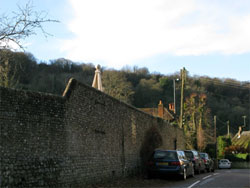
Being a country lane, (albeit inside the village), the road is characterized by the total absence of footpaths. It is quite narrow, lined by walls, banks and high hedges to both sides where there are no houses. Very often this seems the coldest part of the village, a real frost hollow. Where the road turns east is the footpath entrance to Ewell Field. From here the road starts to rise (and warms up in winter) as it heads up to the village centre. A mix of houses, old timber framed, thatched, Victorian brick and more modern, line the north side of the road and their elevation rather disguises the fact of Gracious Street is a sunken lane. On the south side at the bottom of the slope, The Wakes’ Park is elevated above the road by some metres but this reduces as it reaches up the hill past the ex-stables of the Wakes, now converted to a significant dwelling, and a small cottage. Both have gardens that back into the Wakes parkland area.
It is not possible to see the park gardens at this point because of the huge stone wall that curves around the top part of Gracious Street hiding the Wakes garden. This wall, originally only one metre high and built of a stone/brick mix, but in the Victorian period a three metre flint extension was added.
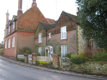
Selborne School (739337) with its recreation field is immediately north of Gracious Street, and can be accessed from the B3006 (main) or from a pathway that cuts through from Gracious Street. This is a successful primary school accommodating children from Selborne and its surrounding villages. The building is a hybrid with an early building, (17th C?), a Victorian school house, and a modern extension that completes the enclosure of the building’s frontage.
The school sits in a small deep valley running East – West with the land rising steeply on both sides from the Seale Stream bed. The access road off the B3006 has an area for dropping-off, doubling as an informal parking area. The Seale Stream runs the full length of the valley flowing from Gracious Street under the B3006 road bridge and into Kimbers Field which is the valley extension to the east on the other side. The valley is wooded to the West but open into Kimbers. There are views into the private gardens of houses along the valley, but there is a strong sense of enclosure formed here by the steep sloping ground, the tall trees and the stone walls.
The area is bounded by a dilapidated fence along the stream edge. This area is busy during school drop off times and there is significant litter left around which needs management. The School refuse bins are very visible and would benefit from some screening.
The B3006 Road is very steep as it drops down and then up again either side of the bridge, with a school crossing point at the bottom, adjacent to the bridge. Unusually for Selborne, this area is punctuated by modern street furniture and fencing in an attempt to protect pedestrians from the high levels of traffic using the B3006. Stone walls rise tall on either side of the road as it climbs south into the village.
Culver Croft (739339) (Most frequently but erroneously called Burlands) is an old Grange Farm field, bounded to the southwest by the Grange farm development, to the north by the hollow lane, Cow Lane, (FP 502), to the south by Lythe House and to the east by the B3006. (The original Burlands was the name of the field on the north side of Cow Lane: see Tithe Map 1842). Culver Croft is relatively flat, and it provides an excellent open view to the hanger. It is crossed by an old footpath, FP20. The field is mostly hedged but has a wall next to Lythe Bank and panel fencing behind Grange Farm House. The field’s management has not included cultivation in recent years but it is now left as grassland. It has been the subject of regular but unsuccessful speculative attempts at commercial and housing developments: once even a petrol station was proposed.
Goslings Croft on the eastern side of the B3oo6, adjacent to Kimbers and Church Meadow. On the western side of the road are the Withers and Burlands fields. 024
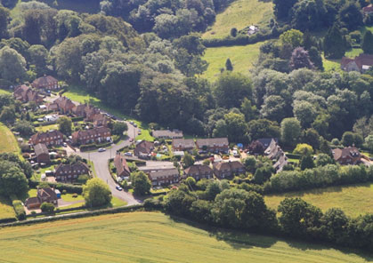
Goslings Croft (740340) is an ancient field name passed on now to a mid-20th century public housing development at the northern extremity of the village settlement area on the eastern side of the B3006, across from Culver Croft (Burlands). The access junction is also the crossing point for Cow Lane and eventually dips down behind Goslings Croft to the Lythes. Immediately south of the junction is an unattractive traffic calming chicane. Goslings housing is conventional brick and tile, and medium density. All communal areas in front of the housing are grassed, managed by the Parish Council and generally well maintained. To the south of the built-up area the view is of Kimbers Field, with the Seale Stream bisecting its length. To the south east is a public open space, a former playing field, with an area now fenced off and used as allotments. The area is generally level. Around the allotments the land is being left to grow naturally into a wild flower meadow. It is a haven for wildlife and is set within substantial mature woodland to the southeast including larch, beech, sycamore and ash. The footpath from Burlands runs through this area but views are enclosed by the tall surrounding trees, the only view out is towards the Goslings Croft cottages to the west.
The woodland, now managed by the National Trust and East Hampshire District Council (see below), was originally planted by Magdalen College with beech and larch around 1800, during a period when commercial ‘plantation forestry’ was becoming fashionable. Many of the Larch are now very tall and some have fallen.
There is slight noise from the road but it is generally quiet and deer are often seen at the woodland edges.
Kimbers Meadow (741338) corresponds with the eastern end of the steeper section of the Seale Stream valley that cuts across and helps to define the northern limits of the old village area. Along with Church Meadow it separates the main settlement from Goslings Croft to the north. It is bounded at the western end by the B3006 road (New Road) which sits high up on an embankment that crosses the valley, meaning that Kimbers is passed but not seen by thousands of drivers every day. It is a steep sloping valley cut by the Seale Stream, running east and continuing to narrow with no valley floor. Like a number of meadows further downstream this meadow’s management includes grazing with livestock and occasional hay cutting and topping although the topography makes work with tractor-mounted machinery difficult. The margins of Kimbers along with areas within the field are well endowed with stands of trees and scrub. Over the decades the encroachment of scrub and its development into small areas of woodland has given the meadow the appearance and attributes of a small area of wood-pasture – there are numerous old open grown veteran trees that have considerable biological importance. The public can access Kimbers from Church Meadow to the east but there are no through routes or paths (This allows livestock to be isolated away from the popular and statutory footpaths through Church Meadow and the Lythes, so that they could remain open if for example, there was a disease outbreak – a lesson learned from recent Foot and Mouth quarantine regulations). A footpath (FP501, the Short Cut) runs along Kimbers’ northern boundary next to New Road Cottages connecting New Road (the B3006) to Goslings Croft. Although by no means remote, the isolated situation of Kimbers confers it with less human disturbance than other popular places in the countryside around the village. Amazingly, deer often raise young here and the rare Harvest Mouse nests have been recorded along the boundaries of the grassland and scrub. There are many natural sounds, birds, grasshoppers etc. but the road with its noise and smells, is an intrusion, disturbing the tranquillity. Nevertheless, there is an atmosphere here, one going back in time: there are numerous deer and badger tracks through the grassland and it feels close to nature but it is damaged by the proximity of the road. Along the valley bottom, where there used to be two long narrow ponds the ground is now usually wet and boggy. Plants such as Kingcups and sedges are common here. Close to the boundary with Church Meadow a large Grey Poplar stands on what was once an island in the lower pond. Suckering from the roots of this tree have produced a small grove of Grey Poplars surrounding the parent tree. Along with several old oaks, ash, sycamore, field maple and hawthorn, the poplars provided useful cavities for birds such as woodpeckers and insects such as bees to nest in.
In Rye’s book on pp.233 to 234 he discusses whether it is worth grazing it and maintaining the hedges, “What is to be done with this once so lovely field? They alone, the farmers, carry on ancient country traditions.” Rye need not have worried; with NT management there seems little threat to this field, but the pollution damage from the road together with cutting it off from the village mean that it cannot be enjoyed as it would have been in the past.
See this…Church Meadow descending. 836
Church Meadow (742338) is a famous Selborne beauty spot and, with the Wakes, the Church and the Zig Zag, is probably the most visited part of the village by tourists. It is also popular with villagers; just for the view or to picnic, to walk, to run, to paddle, for bird-watching, drawing and painting, for egg rolling at Easter or sledging in winter.
At its most northerly point, Church Meadow is a continuation from Kimbers of the Seale Stream Valley, still with no valley floor. There is a boundary fence between the two areas. Access from the village centre is through the churchyard, then via an old wooden kissing gate of novel design that allows for removal of a section to permit the passing of push chairs, wheelchairs etc. The gate exits on to the highest point of Church Meadow, giving breath-taking, beautiful views in all directions from this spot. The viewing location, complete with a Millennium Seat, is on top of a mound or spur, formed because the hillside to the immediate south was quarried, leaving a deep pit that extends across Huckers Lane. Much of the quarried malmstone was used for construction of the Church.
……from here where the Millenium Seat provides rest after the climb up. 837
The views from the Millennium Seat are simply stunning.
- North, across to the Short Lythe with The Plantation of beech and larch, and down to the stream in the foreground.
- North East, down to the large Oak, the meadow and stream, Dorton Cottage and the woodlands of the Long Lythe and Dorton hemming in the narrow valley meadows, with the valley widening.
- East, the wooded Sparrow Hanger with Jacob sheep grazing and the fields of Oaktree Farm beyond with the Devon cattle.
- South and West. The margins of the village centre and Selborne Church and Graveyard.
At the bottom. The old oak is reputedly the largest tree, by volume, in Selborne. The Hanger is in the background. 216 (winter view).
At the bottom. The old oak is reputedly the largest tree, by volume, in Selborne. The Hanger is in the background. 216 (summer view).
This is a historic meadow where improving biodiversity as well as maintaining the landscape is a key consideration for the National Trust. The hollowed out area, once the quarry, is next to the churchyard to the south (looking towards Huckers Lane and Dowlings) was retained by the church authorities as a future extension to the graveyard. Along with the rest of Church Meadow the church owned part of the meadow is currently managed by the NT with the agreement of Winchester Diocese as there is no fence or hedge currently separating the two ownerships. Within the meadow there are 3 mature oak trees. The largest oak in the village is at the bottom of the slope, has a wooden bench underneath and is by the stream. The other two oaks appear to be under some stress –dieback and crown thinning, probably due to a combination of factors including advanced age, root damage caused by trenching some years ago when the foul drain was routed through Church Meadow. A sapling oak with surrounding fencing was planted by the villagers as the millennium oak. A Jubilee oak is to be planted nearby.
At the far eastern end of the meadow is Dorton cottage, where the Seale Stream meets the Wellhead Stream, and they become the Oakhanger Stream. Note that the Seale Stream is prone to running dry, but the Wellhead has proved reliable year round, to feed the Oakhanger Stream.
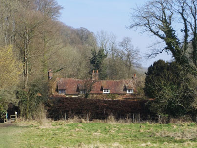
Dorton Cottage at the bottom of Church Meadow. 001(2)
Apart from all the human leisure activity, there are other land uses including cattle grazing and occasional hay making (for the conservation and restoration of the meadows flora and fauna) and the stream is used by the Wakes Museum Field Study Centre for teaching natural history. At the bottom of a steep slope where the gradient flattens, there is a narrow floodplain which broadens out to the north east. Here the stream takes on a meandering character as it loops around Dorton Cottage forming several horseshoe bends.
Access to the Lythes from Church Meadow is via the well-known Hangers’ Way path (FP26 here) ; this passes through the kissing gate on its way into the village. An alternative access to the meadow is a stile into the meadow from the adjacent Huckers Lane, providing a variant and alternative to the steep climb up Church Meadow.
The north facing valley side is grassed and the stream terrace rises up quite steeply and irregularly. (This is a continuation of the ‘man-made’ mound of soil and material cleared from the church yard. In places it is so steep there are small patches where it has fallen away or eroded. This slope was a narrow coppice woodland, known in White’s time as Church Litten Copse. By the 1840s the copse had gone and today it supports botanically-varied grassland, noted for its display of primroses in the spring. At the top of this slope the church yard and the Old Vicarage gardens are just about visible, with a number of mature conifer trees which stand out.
The stream topography and the V-shaped valley very much define the boundaries of this landscape, and it is a place to allow all senses to be satisfied.
“takes on a meandering character” 229
Sounds: grasshoppers, bees, wind in the trees and bird song, with the rookery opposite in the Short Lythe often filling the air with squawks and craws typical of these birds – perhaps emblematic of Selborne.
Smells: grass and slight fragrant flower scent, buttercups, scabious. Colours: sunshine yellow and shades of green. Feelings: bees and butterflies – natural countryside beauty.
Heading east on the Short Lythe path, a section of the Hangers Way. 230
The Short Lythe (743339) is the steep south to south-east facing valley slope that overlooks Church Meadow and Dorton Cottage and extends from Kimbers to the Rifle Range. This wooded slope, a hanger, can be divided into three zones. When approaching from the village through the churchyard, the part that is seen first is the Short Lythe Plantation, which is an area of mixed woodland containing, tall mature larch along with ash, sycamore, beech and field maple. Planted in the early eighteenth century, this woodland replaced an area that was reported by White as being a steep pasture interspersed with furze’ (gorse). This was famous for its field cricket colony, which disappeared when the plantation was established. It is also the place from which Grimm sketched the picture that formed the frontispiece of the Natural History of Selborne.
Above, there is a thin strip of beech (hanger) woodland running along the margin of the Goslings Croft housing estate – this is owned by EHDC, and is called the ‘first woods’ by Goslings children.
The third section of the Short Lythe is the older beech hanger woodland above Dorton Cottage which has the characteristics of an ancient woodland although historically this too was part of an area where livestock were able to graze and therefore probably better described as relic wood-pasture. Except for the ‘first woods’ these valley-side woodlands are owned by the National Trust with the extreme north-eastern tip being part of the Lythes SSSI. The trees and woodland here have a critical place in the landscape when viewed from both close at hand here, in Church Meadow, and from further afield, from the top of the Zig Zag.
The recently restored path off the Short Lythe across Dortons. 231
The valley bottom contains the Seale Stream and the private land and gardens of the historic Dorton Cottage at the eastern end. Access along the bottom of the north-eastern section of Short Lythe woodland is via a wooden bridge over the Seale Stream at the eastern end of Church Meadow and follows the narrow Hangers Way footpath (FP26) along the lower part of the very steep south-east facing slope.
There is undergrowth and mixed hedging through which there are glimpses of Dorton Cottage and its garden. There are no long-distance views at this point due to the enclosed nature of the woodlands.
The path then rises and looks down on a meander in the now Oakhanger Stream, the Wellhead Stream having merged with Seale Stream by this point at Dorton. Past Dorton Cottage the Short Lythe changes direction to the northeast. The ancient character of the woodland and its trees along this section of the Short Lythe and the fact that it is protected within the Conservation Area and as part of the SSSI, means that care needs to be taken when carrying out woodland management. In 1988 some felling was necessary in a small section of the woodland to protect Dorton Cottage from trees that were damaged in the Great Storm. There is an on-going programme of tree management, with limited felling and tree surgery, which aims to maintain woodland on the slope and encourage replacement through natural regeneration where trees have been lost. Some small open glades are also being encouraged, where appropriate, along with small coups of coppice to create a more varied woodland structure and greater opportunities for a range of woodland wildlife. The retention of some of the felled and fallen slowly rotting wood, adds further habitats that benefit the general woodland ecology. Just beyond Dorton is a restored, (and newly created statutory) ancient pathway that cuts south through Dortons land across the stream and emerges at the bottom end of Huckers Lane. At its midway point thorough the Short Lythe the Hangers Way path becomes progressively steep, rising over 20m.
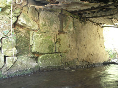
Here there are almost overhanging Greensand cliffs, looking like a built wall intertwined with beech tree roots. (224)
In fact there is clear evidence of ancient quarrying activity. It is very easy to miss but it is possible to discern where the rock face has been partially cut and squared off ready to transport away for local buildings. There has been a sequence of fallen trees, mostly beech, and this has necessitated maintenance to the pathway by the National Trust, with edges having to be built up with wooden supports on the down-slope side. The pathway leads past the privately owned Broad Meadow (an SSSI), and continues to a kissing gate that leads to the southern end of the Rifle Range. Up to this point there is a real sense here of enclosure, at all times, a magical section of woodland walk looking up at greensand cliffs and down to a stream and meadow.
The Rifle Range (742342) is an immediate but brief change of scenery, seemingly a clearing, but in fact the lower end of a gently rolling or undulating dry valley between the two Lythes that is not part of the NT ownership along the valley. The valley’s name comes from when Victorians and Edwardians (ladies and gentlemen) used to practice shooting across the valley from various markers placed at 50, 100 and 150 yards from the target. There is an old photograph showing this activity.
It is not possible to see the long gone old wooded platform at 50 yards where this took place but apparently a hawthorn bush on the south-west facing side of the valley marks the target location.
The dry valley was probably created under peri-glacial conditions, but has been much changed by human intervention. It is part of Coombe Wood and Lythes SSSI and is strictly speaking pasture land, although because it has not been grazed in recent times, it is becoming fairly scrubby. Four footpaths join near the bottom of this valley, the Short Lythes footpath, the Long Lythes a steep slope up the east face of Short Lythe back to Goslins Croft through the private beech woodland, and one not very visible up Rifle Range valley. The most obvious view is north-west up the Rifle Range valley towards the higher ground called Reading or Ridden (which means cleared land or ridden of trees). In fact the Range is recorded as part of the Reading in 1842, although the valley itself sheltered a hop garden, the rest of the field was arable.
Looking north up the Rifle Range. 233
This is a very attractive view and has great plant diversity such as the reasonably rare Devils Bit Scabious. As this pasture land is not being actively grazed the vegetation succession is altering, gradually becoming colonized with more bushes and young trees. For example, the slopes are becoming covered with brambles and there are a few very small oak saplings. This valley meadow and its ecology is dependent on farming practices, the best being the traditional ones – livestock grazing and hay making. However, some scrub is beneficial and recently Brown Hairsteak butterfly eggs have been found on the blackthorn growing at the margin of the field (thus extending the range of this isolated local population centred on Noar Hill). Recently some topping has been carried out (in the absence of grazing) to check the growth of rank grasses and ruderals such as docks and thistles. The Rifle Range not only links a network of footpaths, popular with locals and visitors, but also along with Broad Meadow, forms an important ecological connection along the valley between the woodlands and meadows, thus its inclusion within the SSSI.
The view up the Rifle Range is one that progressively widens, with a distinctly different feel from all the immediate surroundings. Where Rifle Range joins the Oakhanger Stream valley (facing south-east) there is no view as there is dense undergrowth and hedging. Looking north-east, through the gate, there is a glimpse of the slightly rising Long Lythe footpath through the beech woodland. To the south-west, also back through a gate, there is the wooded Short Lythe footpath. The physical landscape of the dry valley dominates the location, along with the woodland on three sides. The Rifle Range valley acts like an open funnel adding space and light to the junction of these four footpaths. At dusk it is an atmospheric place with bird song and Tawny Owls. Smells of damp woodland and biting insects are evident.
Top of the Rifle Range. (742342) From the top there are views down the steeply sloping Rifle Range valley towards the Oakhanger Stream and Broad Meadow at the bottom of the Lythe valley. This area has mown grassland and is adjacent to an un-harvested arable field, (at the time of the survey). Rooftops of Goslings Croft are visible looking south. Access to this area is via the Hangers’ Way path or, originally more common, from Gypsy Lane (FP27) which leads in a north-easterly direction from Goslings Croft. This pathway is still well used by dog walkers and is enclosed by tall hedgerows on either side creating a hollow green tunnel. The northern hedge is more mature with some large oak and ash trees interspersed with hazel and the southern hedge has been cut more regularly in the past. There are bird-boxes on the trees. Gypsy Lane is named after travellers who would have come to the area for the hop-picking each autumn and who parked caravans along the lane. (The Rifle Range was once a Hopfield – see above). The un-harvested cereal crop is providing an excellent food source for birds. Tall hedgerows of approximately 2m surround the pastureland and are interspersed with mature trees. This is a reasonably quiet area, once along the path and away from the road, with only the sounds of chaffinches, robins, bees and rooks from the nearby rookery located in the high trees adjacent to Goslings Croft to be heard.
The Long Lythe (743339 to 748344) is owned and maintained by the National Trust and combines ancient woodland and meadow on this south-facing slope. It runs along the northern side slope of the Oakhanger Stream valley facing Dorton Wood. Lower Burchams, the meadow on the south side of the stream is also owned by the National Trust. (Upper Burchams, on the facing south slope is owned by a local farm). The land use combines nature conservation (SSSI and part of the Hangers SAC) with public access along footpaths on both valley slopes.
The view from the east with the Hanger in the background. 241
The Long Lythe, looking east along the Hangers Way. 240
Historically this unit of land was divided into the Long Lythe with wood-pasture on the steeper upper slope and hay meadow below between the ‘hanger’ and the stream, A small enclosed meadow, Lythe Mead, occupied the wettest part of the valley bottom at the west end. From around 1919 the lower meadow area became a forestry plantation, firstly being planted with larch and sycamore and latterly (from 1958) with fast growing poplar trees for the match industry. After the poplars were felled in 1993, the National Trust with the support of Natural England (Countryside Stewardship Agreement) have restored the lower valley area to a meadow and re-established the historic field pattern, based on one of the early maps of the site from 1678. With this part of the landscape having been significantly altered by forestry, the restoration of species-rich grassland usually has to be measured in decades. Following work to control scrub and rank vegetation in the early stages, the grassland is beginning to acquire many of the species associated with wet meadow eco-systems. Cuckoo Flower (Milkmaids) cowslip, knapweed, Common Spotted orchid, Betany and Devils-bit Scabius, to name but a few have reappeared across the restored meadow area and can be regarded as a mark of success. A regime of light grazing and occasional hay cutting is being adopted to maintain the site’s developing ecological diversity. This mimics a traditional pattern of management that was used in all the meadows along the valley from Saxon times until the twentieth century when the ways of working on these grasslands changed significantly.
Since the 1930s, 95-98% of the UKs species-rich grasslands have been degraded or lost. The work in the Long Lythe contributes both locally and nationally to a programme that attempts to halt further losses and re-establish the networks of traditional grassland habitats.
The Long Lythe is another major village attraction, for the most part an easy stroll, with continuously beautiful views between the village and the ponds at Great Mead. The Long Lythe path starts at the kissing gate from the bottom of the Rifle Range, and is a significant section of the Hangers’ Way path. It is popular for walking, running, bird watching and picking blackberries for both locals and tourists. At the sides, this is a steep wooded valley heading north east, with a gentle curve to the east for a little over 500m that gives interesting views in all directions but particularly looking back towards Selborne Hanger. At about two thirds distance, there is a metal bench seat, much used, (and occasionally littered), set in a position that best traps the evening sun, avoids any winds and generally encapsulates the tranquillity of the place. The views from the bench are constrained by the vegetation and the trees but, directly in front, looking south, it is possible to see the woods of Dorton on the opposite valley slope. Below this are the tops of the trees in the meadows by the stream and beyond the hedge by the opposite path, the Via Canonorum adds to the frame-like quality of the view from this bench, although the wire within the hedge could be considered a little intrusive, but this hedge has recently been laid, which should improve it. Looking south-west there is the tree lined Hangers’ Way path towards the Rifle Range and Short Lythe and in the opposite direction (north-eastwards) the Long Lythe path continues. At this stage it also appears tree lined. Behind the bench are the Long Lythe woods. The trees and vegetation very much frame the view from this metal bench and give it strong edges.
The Long Lythe is a very tranquil place but there are many sounds: buzzards, pigeons roosting, children playing in Church Meadow, and the occasional mechanical interruptions from machinery on Redden field above Long Lythe wood. All these sounds are very clearly heard because of the naturally occurring acoustic properties of the valley. Conversations on one side can, at times, be heard on the other side. All the senses are catered for: there are many smells, wild-flowers, blossom, grass, leaves and at certain times of year the strong smell of wild garlic. The valley is a feast for the eye; it is an extremely diverse habitat with numerous butterflies and wild flowers plus occasional deer and wild duck. The Long Lythe is much loved and used by the village.
Far Copse (747344) is a small copse in an elevated position with good views at the north eastern end of the Long Lythe woodland, where it turns north towards Long Copse. The woodland is bounded by a hedge of elder. There are limited views to the north across an undulating field with a tussocky field margin and cultivated with cereal crops. To the northeast the view is to Long Copse and Milking Hanger, and to Wick Hill, with the farm oasts visible when the trees are bare. There are more distant views south east to Coombe wood and Wick Wood. There are distant views to Bush Down and the Four Marks hills to the west: Selborne Hanger to the south west and Noar Hill to the south. Pylons are highly visible on the skyline and detract from the scanning view to west and northwest.
The National Trust has noted that some of the tallest beech trees in the parish are located in this small area of woodland (circa 35m tall). There are also some large holly bushes and fallen deadwood which is probably difficult to extract but is beneficial to the wildlife. This is a very peaceful spot with plenty of bird song, a big sky and dramatic cloud formations on some days. There is a deep lynchet on the edge of the wood and there has been speculation in the past that there was once a settlement in this location.
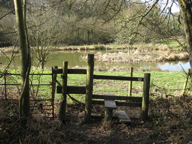
Great Mead (748344) below and east of Far Copse is today a low lying field with a network of three ponds. Historically there was a single pond linked to The Priory, but in recent years the two new ponds have been created by excavation of the old wetland bog areas that were SSSIs (now damaged) in Great and Little Mead. The Great Mead ponds are an attractive venue for walkers with the Hangers Way and other local paths crossing the field. There is an abundance of wildlife here, with deer, buzzards, herons, swans, mallard, coots and moorhens, canada geese, and in the ponds oversize goldfish, large carp and thousands of frogs.
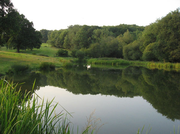
The original Great Mead pond, looking north with Coombe Wood on the right and Milking Hanger rising beyond. 623
Via Canonorum, (Dorton and Priory Lane) 743340 – 755345. The track extending from Dorton Cottage to Priory Farm, sometimes called Priory Lane and in recent times Via Canonorum, runs along the southern side of the Oakhanger Stream valley. The route forms part of a popular circular walk that takes villagers and walkers past the church, through the Lythes to Priory Farm before heading back along the opposite side of the valley via Dorton and Huckers Lane. Many feel this part of the countryside has a special quality of secluded, quiet tranquility just a short walk away from a busy modern village.
The Wellhead stream at the bottom of Hucker’s Lane. It merges with Seale stream to become Oakhanger stream by being piped under the lane at Dortons. 144
The path has an ancient pedigree having served for centuries as a principal highway between Selborne Priory/Priory Farm and the village. The section of track through Great Dorton (often called Dorton Wood) still retains fragmentary remains of an old metalled surface of malmstone cobbling and pebbles (where it hasn’t been damaged or destroyed by modern motorised traffic). A well-engineered all-weather route gave the medieval priory a much-needed link with the village, the principle settlement from which its local estates and lands were administered and managed. The arrival of the twentieth century and heavier and more frequent motor traffic has done considerable damage and in recent years repairs have been carried out with modern materials. Because of its historic importance and the risk of further degradation, ‘Via Canonorum’ is the subject of a Traffic Regulation Order (TRO), which now restricts usage to walkers and horse riders although the landowners can access their land with vehicles and machinery for undertaking management (Current land owners are careful to avoid further damage to this historic route).
The Oakhanger Stream valley with its sloping hanger woodland which has cut a ravine through the Upper Greensand outcrop to the east of the village is the dominant topographical feature in this part of the landscape. The valley could well have been used as a natural route from the Weald to the Upper Greensand bench and beyond on to the chalk and vice versa for millennia.
By Dorton Cottage the track crosses a fairly flat area beside the stream that was formerly a small green which linked with and was part of the former Dorton common extending along towards Priory. Now much changed with a modern stable and garage building and new hedging to form small paddocks, this part of the old common now has an enclosed feeling (in 1958 planted with a poplar plantation felled in the 1990s). There is considerable charm afforded by the isolated and ancient Dorton Cottage and by the trackside streams, which converge here. The brick culvert, which carries the Wellhead Stream under the road, is guarded by metal railing beyond which there is a wooden footbridge leading to the cottage. Another path (recently given statutory status) just beyond the cottage joins and links through a gate in the new the hedge and across the stream to the Short Lythe (Hangers Way) path via a modern footbridge. Moving on, the track starts as a sunken lane and is the narrow neck of land that joins the green by Dorton Cottage to Great Dorton. On the north side an old hedgerow, now dominated by mature and overgrown hedge of hazel, ash and maple pollards, overlooks a scrubbed over and very wet former meadow (Dog Ford) sloping down to the stream. On the south the steep meadow Hanger Close (or ‘Hungry Purrock’ in old local speak) curves away into Little Coombe, a small valley set at a right angle to the main valley. Large open grown oaks and small patches of hazel copse are a feature along the margins of these enclosures. At the top of Little Coombe, about 200m from the track and fairly well hidden is the village sewage works.
From this point the track curves around a steep shoulder where the two valleys join before it straightens out to roughly follow the 110m contour half way up the valley slope. This part of Dorton has provided village children, and adults, with a place to play and rest for many years. Rope swings regularly appear on the branches of the beech trees allowing those brave enough to swing out over ground that falls away steeply to the stream below. The less adventurous can sit on one of the village’s late nineteenth century iron seats which partially over-looks Broad Meadow through the canopies of trees and scrub. Being at the base of an ancient beech (well inscribed with the initials of several generations of village children and lovers) the buttresses growing around the ironwork cause curiosity and highlight the age of the seats. 140
“The track here is carried on a narrow terrace” 141
140
The track here is carried on a narrow terrace overlooking the broad channel of the Oakhanger Stream glimpsed in the valley bottom. Above and below the woodland is dominated by tall beech with some oak and one or two fairly large semi-mature Wych Elm that have so far avoided elm disease. A few of the former veteran beech that stood in what would have been more open common ground catch the eye through the tall straight stemmed beech high up on the bank above. At the boundary of Lower Burchams meadow (also known as Blacksmiths field – see NT Selborne Common newsletter #2 Winter 2010 for definitions) the woodland on the upper slope continues while below the meadow defined by hedging and enclosed with a fence slopes more gently towards the stream. Having been one of the few old meadows to have avoided ‘improvement’ by reseeding, drainage or chemical inputs, the National Trust acquired this area to add to the adjoining Long Lythe during the 1990s. The range of traditional meadow plants that have survived here make this an ecologically valuable area of semi-natural grassland. Managed by sheep and cattle grazing and the occasional hay cut this site forms a key local-provenance ‘seed-bank’ for restoring plant diversity to other former meadows and wetland areas along the valley. Along with Dorton Wood, Lower Burchams lies with the ‘Lythes and Coombe Wood SSSI’ and the Hangers Special Area of Conservation. The Dorton woodland is important for a variety of plants and insects such as toothwort and green hellebore, while the old grasslands have species such as devil-bit scabious and betony. Undoubtedly, the juxtaposition of the habitat types creates ideal conditions for a range of invertebrates which are not as well recorded along the valley. Woodland birds are common with rooks and crows often heard, and buzzard regularly seen. Firecrest has been recorded here in recent years, but wood warblers have disappeared.
Beyond Lower Burchams, woodland (more mixed with willow, oak, ash and hazel) again occupies the gentle slope between the path and the stream. Some larger oak and beech stand as silhouettes amid this younger secondary woodland. The upper side continues as a steep hanger with old beech maidens. The path emerges at the end of the wood out onto an embankment and along the southern margin of an undulating field that occupies a broader floodplain on the south side of the stream.
Via Canonorum heading for Priory farm as it emerges from the woodland. On the far side are Coombe and Wick Woods. 137
From this point eastwards the steep hanger woods and intimate meadows are replaced by a more open landscape of pastureland that cascades down the less abrupt and longer slopes to the south into a flat, broad valley floor.
The field that opens out and then tapers towards Priory Farm was once two, Mill Meadow by the stream (possibly a former water meadow) and Long Close above where the path runs. Small copses and woods are glimpsed through gaps and gateways in the tall rambling hedges of bramble, dog rose, hazel, ash and field maple, while across the field a line of tall lime trees mark the course of the stream at the far end by Priory Farm. The margin of Mill Meadow’s boundary with the stream at the western end is marked with ash, oak, maple, beech, hazel and hawthorn. Further along the path towards Priory a view up into Conduit valley on Oaktree Farm to the south appears, an area of sloping ground with numerous folds and ripples from slumping and from stone and clay digging in centuries past. The grassland here appears unimproved and species rich in contrast to Mill Meadow where the vegetation takes on a simple range of grassland plants typical of agricultural pasture. These pastures are typically very wet and prone to rutting with modern machinery. Sedges and wet grassland species, sedges, rushes, and fools watercress etc, occupy ditches and boggy areas along with few alder bushes. Across the valley back towards the west there are glimpses of the end of the Long Lythe and Norton Farm’s arable field above Long Copse.
A power line on wooden poles across the meadow is fairly unobtrusive as it sits below the tree canopy line of the surrounding woods and hedges. At this point the geology is changing to from Upper Greensand to Gault Clay and from here eastwards the landform, hidden from view at this point, changes to a broad vale across towards Oakhanger. The steeper greensand hangers recede away unseen behind hedges and woodland north and south.
At the end of Dorton Wood, the woodland boundary with Mill Meadow slopes down to the stream at the site of a former priory mill. This was once one of the ways (along with the former bridge 150m upstream) of taking a short cut across to Great Mead (Coombe Meadow) and the Lythes on the opposite side of the valley. Lying at the corner of the wood and at the end of a long narrow meadow (Bridge Foot) on the north side of the stream this crossing point bridges the stone-lined wheel pit of a medieval mill. The structure is now reduced to the fragmentary remains of fine malmstone block work (134 above) standing only a course or two above the water level. One structure forms a spillway into first upper pool (presumably the former mill pond) while the second structure carrying the modern and recently strengthened bridge, corresponds to the wheel pit, from which the stream discharges into a larger pool or ‘tail pond’.
CENTRAL UPPER GREENSAND Character Area – 6a,
Includes: The Plestor, The Church, The Street, Hastards, Honey Lane and, at the southern end, Ketchers Farm.
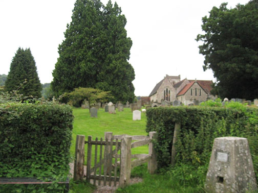
Photo 577
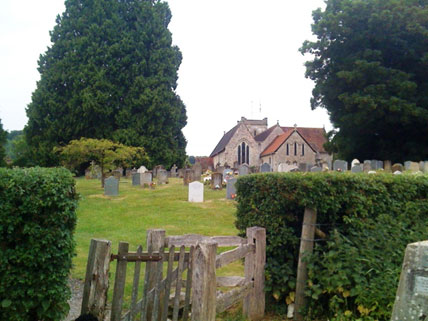
The Church and Churchyard. (742338) The church, an impressive 1000 year old building with more recent additions, is on the south side of the Seale Stream Valley, overlooking Kimbers Meadow to the north. It sits immediately behind the The Plestor, making its position very central but is quiet and secluded, with open land and long views over Church Meadow and The Lythes stretching away to the north east and east. The church building is on the northern side of the very grassy grave yard area that slopes gently down to the top of Church Meadow. This is the edge of the Upper Greensand Terrace.The space is enclosed by tall trees to the North and West, but there are glimpses between trees to the Hanger in the South West.
The graveyard is kept tightly mown in areas close to the church and the recent burial plots, but left to grow as a wild flower meadow for the remainder, except for the mown access paths. There are two access paths from The Plestor: the main walkers’ path FP26, (the Hangers Way), cuts directly through the churchyard from the Plestor past the War Memorial to Church Meadow; the second path from the northern corner of the Plestor to the church door, passing the remains of a once-famous and historic old Yew tree. This path continues to access Gilbert Whites grave and the north east corner of the graveyard area. The churchyard is well sheltered from wind and is a tranquil place, with plenty of birdsong and little evidence of traffic noise. It is picturesque and photogenic with many interesting gravestones.
The church was built with local stone from the adjacent quarry in Church Meadow and sits square in the landscape with squat architectural forms.
There is a good sense of enclosure provided by the mature trees at the boundary of the churchyard and lining the distant views of the Lythes and Hanger. The predominant colour is green from the trees and grass.
The North Street. (739338)
“enters without pavements, beneath the high wall”. (171).
The B3006 Selborne Road from Alton enters the village as it crosses the Seale Stream at the north end of the village, passing the entrance to School Lane to the west and Kimbers on the eastern side. It is now Selborne High Street which in White’s time was called The Street and still is, by people within the village. After School Lane, The Street rises immediately uphill turning south east as it enters the village proper, passing the junction with Gracious Street, entering on the right from the west. This is a hazardous junction: traffic on the Street can only be seen for a brief time in both directions from Gracious Street. Traffic on the Street travelling through the village is a massive issue with the whole village population. The rush hour levels, over 9,000 vehicles each weekday create danger, noise and air pollution, as well as physical damage to historic buildings from illegal HGV trucks that ignore the prohibition signs. This is an on-going situation, and the upcoming Village Plan will be looking to resolve the situation. From the LLCA perspective, the traffic levels do have a seriously detrimental impact on the environment, and limit the enjoyment of the village by both residents and the 39,000 tourists that visit us each year.
View from the Plestor, facing the Wakes Garden with the Hanger in the background. (169)
Entering the village before the Gracious Street junction there are buildings directly on both sides of the road with clear signs that the road was cut through this part to a greater width than the original track that existed when The Street originally continued north into Gracious Street as the main road to Alton. There is an elevated pavement on the east side, right against the house, but none on the west, where a house and a barn are considerably higher than the road below. Ahead to the right is the high wall of the Wakes Garden signalling the junction with Gracious Street that enters without pavements, beneath the high wall. Facing the Gracious Street exit, on the east side is an art gallery facing south as the space opens out on to the Plestor.
Looking east across the Plestor. (166)
The Plestor (742337) The Plestor name originates from the old English word plegstor, a playing place. There used to be a maypole here. It is very much the true core of the old village, being the village green, bounded by buildings that provide a fine architectural mix to the scene. Looking from The Wakes, across the road, there are no less than eight historic buildings on the facing north and south sides. On the north side is the Art Gallery, once an old General Store, now with a new frontage, a Courtyard with a Pottery, The Old Vicarage, not really so old, dating back to 1842, and at the rear is The Church.
On the south side are two fine malmstone and brick houses, Plestor Cottages, (east and west) and Plestor House, this latter showing an obvious change of frontage from the green to the road. The buildings all retain the essence of the Plestor history, well recorded by White, with their frontages having the highest quality malmstone. An exception is the New Vicarage, built in modern times, but tucked away in the top eastern corner. The green itself slopes up from the road to its highest point in the northeast corner at the church gate. Two magnificent large trees each with a circular oak bench provide shade. At the front a sycamore, planted by White’s brother and up the slope an oak dating back to Queen Victoria’s diamond jubilee in 1897. There is a good sense of enclosure, provided by the buildings, and the mature trees of the gardens and the churchyard. The Plestor is heavily used, but not for the historical festivals and markets of the past. Tourists picnic under the trees, walkers use the Hangers’ Way path crossing it, and of course it is the main access to the Church, The Churchyard, Church Meadow and The Lythes. The views are not long but in all directions are interesting, particularly into and out of the Pottery Courtyard.
Sadly the Plestor is usually behind vehicles. (164) As viewed from the Wakes.
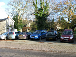
Looking west towards The Wakes, the view is usually obscured by vehicles. Sadly, the green area is very much reduced from its original; it is crossed by a gravel road to access the rear dwelling and a stone sett path gives access to the churchyard. The original track to the church along the northern edge is gravelled. The quality of the grass, particularly under the oak is very poor. Worst of all, from the visual aspect the green is screened by a car park area that has been cut in to provide seven parking places.
Whilst these provide residents and visitors with much needed facilities, they are almost always full and do spoil the view of this beautiful place. The proximity to the road means this is not normally a tranquil place, but when sitting in the middle it does wrap around and imparts a sense of place. Our survey did refer to a jumble of signage and litter bins, disturbing the tranquillity of the green. There is evidence of unauthorised parking on the grass, and this is causing damage.
Plestor House currently has its main door on The Street, but was originally on the Plestor. (165)
The Wakes Museum looks out across the Plestor and runs further along the Street, faced by an equally historic house, Plestor House. There is a road pinch point between the Wakes and Plestor House to facilitate crossing.
The Wakes Museum viewed from the north. (170)
The Wakes (741336) Gilbert White’s House, is a museum that includes the Oates Museum and a field study centre. It is a key historic centre of the village and is known word-wide, attracting over 15000 visitors annually. As well as the two museums, the house accommodates a tea room and hosts numerous village events each year. The Wakes Park is described separately as part of the “Base of the Hanger”. It is adjacent to the Ewell and is a well maintained as a country park and garden, including the famous Ha-Ha that was cut originally to allow grazing at the rear without damage to the garden section. The land slopes gently up away from the rear of the house, with Bakers Hill the highest point at the extreme eastern end. Magnificent views of the hanger can be seen from anywhere in the park.
The Middle Street. South, beyond the Wakes and Plestor House, both sides of the road are lined with historic buildings that include a small 15th C butchers shop, an old ex-Post Office, malmstone/brick houses with thatched roofs on both sides of the road, all with small front garden areas enclosed by hedges and pleached lime trees. There are pavements on both sides of the road at this point, and those on the east, in front of Plestor House are of blue rag sandstone; very durable but extremely uncomfortable to walk on. Further, on the east side, the pavement disappears just before The Queens.
The Queens, seen from the southeast. (157)
The Queens is a hotel and restaurant with a large entrance yard and an historic wooded barn, now housing a delicatessen. The main building of the Queens dates back to 1837, when it was rebuilt after the original Compasses burnt down. Attached to the main building is a modern extension at the southern end, built upon the remnants of what may have been the old brewing shed. Beyond the Queens on the east side is the exit of Huckers Lane, the lane leading to the track now named Via Canonorum to the Priory. The building on the south side of Huckers Lane is an old wooden barn, historically the Old Forge. This was recently damaged by a high sided vehicle passing through the village. On the opposite west side, the pavement is continuous for almost the complete length of the Street but has very narrow sections, sometimes not adequate for wheelchairs or large pushchairs. On the west side, opposite the Forge, Selkwood House, now two cottages, is the tallest village house, again built with brick and malmstone, and is attached to the village shop.
Huckers Lane (743338) is an important historical part of the village centre, being the formerly busy access route from Selborne Priory. It runs from The Street north easterly, level as far as Dowlings then drops steeply down off the Greensand terrace along the valley of the Oakhanger Stream. It is an historic sunken lane that provides access to two of Selbornes’ oldest houses, Dorton and Huckers Cottage, and to the lower reaches of Church Meadow. The paved lane, which is a single track for the entire length, is the first stretch of the ancient Via Canonorum but this terminates at Dorton Cottage. This path continues and is well used by walkers through private land to Priory Farm. (The path is subject to a Traffic Regulation Order to prevent damage by off road vehicles). Entrance to the lane is between The Queens and The Old Forge, and after these buildings there are several new houses to the south in a small cul de sac that have been sympathetically designed to blend with the Village. The new buildings have generally weathered in well, but it is unfortunate more effort was not given to the design and upkeep of the outbuildings. Past the Queens’ garden the view to the north opens across the hotel car park towards the church. Trees and hedgerows enclose the lane to form a dark tunnel, but garden bushes blend with the hedgerows to give a fusion of garden and rural flora.
Huckers Lane with the Queens on the left and the Old Forge to the right. (159)
Old houses line the road sparsely to the southeast on this narrow lane, and there is an old telephone exchange building on the north side. It is small and is industrial in appearance, neglected and totally lacking in sympathy to its setting. At this point the lane drops steeply alongside the southern side of Church Meadow, which is screened by a high bank and with hedgerow and trees with several species. Away from the Street, the lane is entirely rural and becomes very tranquil, with plenty of birdsong in evidence. Appearance however is not enhanced by the overhead electricity cables.
The lower part of the lane descends past Huckers Cottage on the south side, it twists and turns so no long views are possible, but distant views can be made out through breaks in the trees, snatching views of Sparrow Hanger, Church Meadow, and the Lythes. Immediately above Huckers Cottage is an outcrop of the Greensand, a small scarp, the southern end of the quarry dug out of Church Meadow. This does look man made but has been interestingly formed by the large tree roots cutting the malmstone into blocks. Sadly the area under this is frequently littered with dumped rubbish, (including an old iron gate at the time of survey). Sparrow Hanger to the southeast leads off from the bottom of the Lane where The Wellhead Stream follows the road on the south side, until it passes under the road to Dortons where it joins the Seale Stream arriving from Church Meadow.
The merged streams become the Oakhanger Stream at this point. The stream banks are full of wild flowers, but particularly enticing are the wild raspberries along the final section of the Wellhead, that are tantalisingly out of reach on the opposite bank. This area of rural tranquillity is beautiful, full of sounds from the variety of birds and the sheep on Sparrow Hanger but there is a sewerage pump house at the bottom of the hill, an industrial style of building which is quite noisy, and it sits harshly in the landscape. There is also unnecessary street furniture advising of the 20mph limit in this cul de sac.
The Village Shop and Post Office, next along the road, is set back from the road to allow for very limited parking: the pavement is frequently blocked forcing pedestrians to walk in the busy road. The shop is extremely important to the village and is well used by both locals, tourists and passing trade. South of the shop the old houses, built of mainly malmstone and brick, continue on both sides of the road. There are two small shop units on the east side, appended to houses; originally functional village shops but today primarily serve the passing tourist market.
The Selborne Arms is to the south, further along from the shops. It is the second pub/restaurant in the village, with a very small tabled area between the pavement and the historic building that dates back to the 17th C, but not originally a pub. The main entrance, up steps, is a “baffle entry” house, with a chimney immediately facing the entrance: this is very typical of old houses in Hampshire. There is also a small area of car parking adjacent to the pavement that occasionally impedes pedestrian progress. South, alongside the fenced pub garden, is the entrance to the junction of several important points of access. These are the village and pub car parks, new public toilets, The Wakes Field Study Centre, the walk up to the Zig Zag alongside The Piddle and Plum Fell Lane, part of the Hangers Way along this stretch. For such a key village focal point, this part of the Street has an untidy appearance and could be improved, particularly by better and more sympathetic signage. Entering the Car Park area, the land rises gradually towards the Hanger immediately ahead where the crossing is made from the Greensand Terrace to the Chalk at this point. The car park is bounded by fairly dense Wakes woodland but is open to the south and there is a view across the Punfle field.
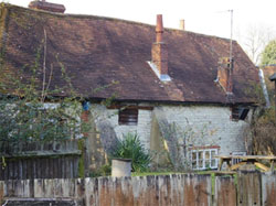
The oldest part of the Selborne Arms. (31/2)
The first area of the car park is part of the Selborne Arms and it is from this point that both Plum Fell Lane and The Walk depart. The back of The Selborne Arms is hidden behind fencing and a high bank with only the roof visible, as is often the case with houses throughout the village.
The area serves as a meeting place for visitors, including many walkers, with a public toilet and the sign-posted path up to the Zig Zag path. The mix of indigenous trees here includes walnut, copper beech, field ash and maple, signalling the junction of agricultural land and domestic gardens. The area generally has good enclosure with tall trees all around and acts as a transition between the Village Centre and the more agricultural grazing land around. Regrettably, there are also leylandii which are not natural to the area. The car park and access road have recently been improved, but some improvement is still needed to the upper part of the car park which serves as the car park for the Wakes Field Study Centre that holds natural history courses, mainly for school groups.
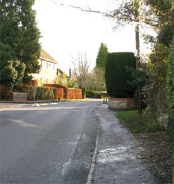
Looking south (153)
The South Street from the car park entrance continues level and straight, and makes the main section, over 400m long, an invitation to use as a race track at certain times despite the recently introduced 20mph limit. Views are restricted along its length in both directions, being limited by continuous buildings and at the ends by the road bending away. Across the road there are views between the buildings; to the west with the Hanger backdrop there are many trees framing the view. The cottage facing the car park entrance is called Hanger View.
To the east, most views are buildings and trees, mostly tall. The buildings to either side of the street are randomly distanced from the road but predominantly closer than in other parts of the village, some directly on the pavement and some set back behind hedges, walls and fencing.
The pavement continues only on the west side, is poor, narrow and with a low curb that overflows with water on to the pavement in heavy rain. This creates a hostile environment for pedestrians. The village has very little street furniture but there is a second pinch point at the southern end of the straight section, where the road turns south, looping around the point of the Hanger arrowhead.
There is no street lighting at all in the village, and the consensus is that lighting would be unwelcome: it would also be entirely incompatible with the South Downs National Park’s efforts to protect dark night skies from artificial light intrusion.
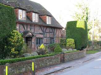
Lassams. 185
As the Street progresses south, there are interesting houses along the way with a wide range of ages and styles. These include a converted gospel hall, a converted chapel, 15thC timber framed houses, Victorian cottages, and a brick 16th or 17th C cottage built to curve around the inside of the tight bend as the road exits downhill at the southern end. Along the way, modern houses have been inserted, most significantly the cul-de-sac development of the old Maltbys industrial site on the east side of the road.
At this southern end of the village Honey Lane branches off to the east. Beyond Honey Lane the last part of The Street, is very narrow and twisting with the pavement less than a pushchair’s width. The road drops and winds out of the village past the last scattering of village houses old and modern. It continues with a new name, Fountain Road to The Lions Mouth where it crosses the Wellhead Stream and on by Ketchers Farm, on the east side which incorporates the village recreation field, complete with allotments, and to the south a small community housing development.
Peel Cottage. 188
The whole length of the Street is rarely a tranquil place during daylight hours. The road is inevitably noisy and the vehicle drivers are totally unaware or uncaring that their speed and noise destroy the tranquillity. During rush hour periods birdsong cannot be heard, although the birds are there, and a healthy population of blackbirds, robins and thrushes do try to compete. They only win at weekends.
Honey Lane (745333) is an ancient route to Blackmoor and beyond. At the southern end of the Street, right where it turns south to round the tip of the arrowhead, Honey Lane branches briefly straight on, downhill off the B3006 only to turn at 90 degrees uphill to the east, immediately becoming a sunken lane, overshadowed by trees. In wet weather, the lane carries torrents of surface water down to join the Well Head stream which runs under the road at the lane’s lowest point. This section of the Greensand Terrace has a heavy clay overlay on the north side of the lane and it is unsuitable for modern arable crops but today supports cattle farming. Much of the clay is unstable and several of the fields show slippage lumps.
It was described by Gilbert White in the 18thC as the lane to the forest. (The Royal Forest of Woolmer, remnants of which still survive as relatively extensive heath land and woodland around Bordon, still being in the ownership of the Crown and used by the armed forces for training, mostly gunnery practice as we can tell when the wind is in the wrong direction). The lane cuts through farmland on both sides. To the north is Oaktree Farm, the only active farm within the village that backs on to the settlement area. Oaktree farms’ Devonshire beef cattle and occupies the hilly area between Honey Lane in the south and the southern edge of the Oakhanger Stream valley at Dorton Wood and Upper Burchams in the north. The boundary with the village settlement area is the entire length of the Wellhead Stream from where it crosses Honey Lane to the point just before it merges with Seale Stream at Dorton Cottage.
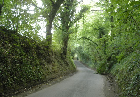
Honey Lane climbs away out of the village towards Blackmoor and Oakhanger. 733
To the south, are large scale apple orchards, part of the Blackmoor estate, that link up with those on either side of Sotherington Lane to the south.
The lane runs from West to East and connects a series of farms but sadly there are many that are farms in name only: there are empty, disused dairies reflecting current national dairy problems. The lane is bordered by high banks and mixed hedges and affords few views over the surrounding countryside. It reaches its highest point, Rhode Hill at 140 meters, in the area of New Barn Farm (752337). From here the ground falls to the North towards Priory Farm and quite steeply to the East towards Blackmoor from the junction with the lane leading NW to Rhode Farm. To the South, the ground rises towards Sotherington Lane, an area now devoted to apple orchards. The lane is narrow throughout its length with few passing places. Wide and heavy vehicles are gradually eroding the high sided banks of this sunken lane as the passing places are widened.
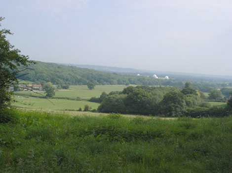
The view north towards Oakhanger, and the Surrey Hills beyond. 735
The adverse impact of off-road vehicles on the BOAT linking Honey and Sotherington Lanes can be seen in the deep ruts that have been formed in its unpaved surface. In winter, it is almost impassable to pedestrians owing to the deep and slippery mud. It is frequently closed by the Highways Department.
The ancient nature of the lane, especially where it is overshadowed by trees and is contained within high banks, communicates itself to the quiet walker who senses that he is not alone. In contrast, however, is the dramatic view northeast from Shrubs Copse (760340) the edge of the Greensand Terrace, towards the giant “golf balls” of the RAF station at Oakhanger and the mixed farmland of Blackmoor to the east. The lane is bordered along much of its length by ancient hedgerows. Where the commercial orchards have been developed, high metal wire protective fencing has been erected to keep out deer. Away from the traffic on the B3006, the lane is peaceful at quiet times but remains an important local route to Blackmoor and beyond it to Bordon taking a consistent heavy level of traffic in rush hour periods. The lane is showing signs of deterioration through the impact of heavy vehicles cutting into the banks. Lynchpin Lane, see below has been rendered unusable by off-road vehicles pursuing leisure activities, and is frequently closed. There is some evidence of waste tipping and poor management of roadside trees.
There is a significant direct threat to Honey Lane, along with both Sotherington and Bradshott lanes from the proposed Eco-Town development of Bordon. Traffic is likely to increase significantly on the lanes to their detriment.
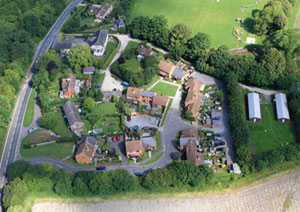
Ketchers Farm. The original farmhouse can be seen at the top, and the Recreation ground is immediately north of the development. 126
Ketchers Farm (746330) is the extreme southern extension of the linear settlement area, on the eastern side of the B3006 road. Once a farm with surrounding fields, it is today an extension of the village, with three main elements, Ketchers Field, a recreation ground, with an area for allotments; Ketchers a small estate of assisted village housing, and the small Pickers Field, used to temporarily house migrant workers on the adjacent Blackmoor Estate commercial apple farms.
The area is set back from the main road and is accessed via a concrete track (FP504) that leads to the Recreation Ground and with a footpath in to Ketchers Estate, rising as it leaves the main road and levelling to the East. The Pickers Field lies to the east behind these areas. This area is semi-wild with patches of maintained ground and access points to the various properties alongside. This becomes a rough grass and track to the rear where the pickers’ huts are located and there are views across the agro-industrial apple plantations beyond. The boundaries of this track are high trees and hedges with glimpses through to the Rec to the North and houses to the south.
The Recreation Ground is large and (a rarity in this area), flat. It is mostly cultivated and maintained grass and accommodates a football pitch, tennis court, a fully equipped children’s play area, and a pavilion. There is a parking area under the trees that separate the field from the track.
Ketchers Estate has its own paved road, a cul-de-sac and is a development of semi-detached and terraced houses built on a raised ground behind Ketchers farmhouse. Designed with a single style of architecture it does not blend with the individual nature of the majority of village architecture. Parking areas have been discreetly hidden away behind houses and walls, but still there is significant on-street parking. Front gardens are undefined, and few have front boundary features.
The estate boundaries are the recreation ground to the north, the pickers’ field with its accommodation huts to the east and the disciplined rows of apple trees to the south. Tall trees border the development to the south and east giving a sense of enclosure, though within the development enclosure is only achieved by the buildings because large scale planting is sadly missing: no trees are evident on the plot.
A stream runs along the southern boundary, set within a double line of trees and hedgerows but there has been no attempt to make use of this to bring it within the landscape of the development. Views are not extensive but both the Hanger to the west and Noar Hill to the south can be seen past the houses.
There is a sense of place and this is helped by the noises of children playing and distant birdsong, but character needs to be developed through more mature planting and individuality to house plots by introducing individual front boundary features.
The Pickers Field looks to be a likely site for extending the Ketchers Estate, and this may present an opportunity to upgrade the landscape both by removal of the old huts, and by planned tree planting in the existing area.
SECTION 3.3
EAST AND SOUTH EAST GREENSAND Character Area 6a,
Includes: Sotherington Farm, Sotherington Lane, Burhunt Farm, Adderhood Hanger, Outshott Hanger, and Temple Farm.
The East Scarp of the Greensand
Terrace
The eastern edge of the Greensand terrace runs south from Rhode Farm, in the north along Shrubs Copse, to Temple Farm where it curves south westerly into the mouth of the Adderhood Stream valley. This is a significant scarp dropping from 160metres just north of Temple Farm to 90m in the flat fields of Albury Farm in Blackmoor.
Sotherington Lane (746326) is a narrow lane with passing places, running from West to East from the B3006, half a mile SSE from the centre of the village. The lane connects a series of farms and eventually reaches Blackmoor. It passes a former hop kiln which became an industrial building in the 1990s, and more recently was converted to 12 apartments of modern appearance. The lane is bordered by high banks and mixed hedges and affords few views over the surrounding countryside. It rises gently on the Greensand Terrace from 127 metres to almost 160 metres at Temple. The land use is principally apple orchards whose acreage has been increased considerably in recent years. At Temple, the lane drops steeply through a densely wooded sunken lane, emerging where the greensand drops away to the Gault Clay vale with mixed farmland and woodland approaching Blackmoor.
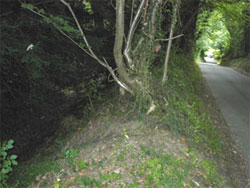
Sotherington “affords few views over the surrounding countryside”. 705
The lane has a number of significant features.
The first is that it forms a major section of the watershed in the area with streams running north to discharge into tributaries of the Thames, and south to the English Channel.
Sotherington Lane is in effect a significant watercourse (now hidden in a culvert) and is a headwater feed for the Well Head Stream.
Just a few metres to the south of Southerington Lane the drainage pattern changes its orientation to feed the headwaters of the Rother.
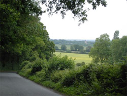
The view to Blackmoor church. 702
The second is that it provides an excellent example of a sunken lane, particularly in the area of Temple Farm. Here, the trees form a dark green tunnel, excluding light from the ancient banks that are now less rich in rare mosses, ferns, lichens, flowers, insects and mammals than in Gilbert White’s day (but still form important linear ancient woodland corridors with high biodiversity value – see EHDCs sunken lane literature from the 1980s : Rose and Brewis etc). Commenting on such lanes in 1782, White wrote, “These rugged scenes afright the ladies when they peep down into them from the paths above …… but delight the naturalist……“ The solution to maintaining and restoring biodiversity may lie with landowners (with the help of volunteers) willing to manage the woodlands, reintroducing coppicing and thereby letting in the light to provide a greater variety of microclimates for insects, animals and plants living there. The third feature is the way that the lane drops down steeply from the edge of the Greensand Terrace.
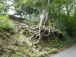
“exposed tree roots” as the road climbs up towards Selborne.
This section offers a reminder that, while lacking the dramatic scale of the chalk scarps of Selborne Hill and Noar Hill, the Greensand Terrace itself forms a scarp that in other locations would attract significant interest. The view to the North East, across the lower level undulating fields of oil seed rape towards Blackmoor Church, is particularly striking. The geological map of the area provided by East Hampshire District Council appears to place the boundary between the Greensand Terrace and the area of Mixed Farmland and Woodland too far to the East along the lane. The boundary lies closer to the mid-point between Temple Farm and Smokey House. The first section of the lane offers grazing but soon gives way to significant apple orchards characterized by staked trees in strict alignment, protected by wire deer fencing. Poplar trees have been planted on field boundaries to offer protection from the wind, following a tradition first established in the area when hop fields were similarly protected. In the sunken lane area, the high banks are rich in badger sets with entrances among exposed tree roots.
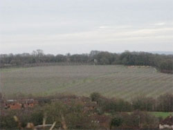
The apple fields as seen from the top of Kings Field. They are a stark industrial contrast to the surrounding landscape. 2012.01.06 4041
In summer, when the tree canopy covers the sunken lane section, there is real sense that this is an ancient place. The adjacent apple orchards also generate less noise than the more industrial noises associated with other types of modern farming. However, at harvest time, trailers loaded with apples trundle down the lane and pass through Selborne village. Sotherington Lane, Honey Lane and Bradshott Lane, all carry progressively more traffic, and all are used as feeders from Bordon and Liphook into the increasingly busy B3006. The development of Bordon as an Eco-Town increases the threat to our lanes. Additionally the increased size of agricultural tractors and machinery has led to the erosion of banks to create larger passing places, narrowing the banks and increasing the tunnel effect of overhanging trees, thus excluding light and encouraging rank grasses that exclude other plant species.
Lynchpin Lane /BOAT 66 is a short byway connecting Sotherington Lane with Honey Lane. It runs north from The Kiln down to Honey lane, and much of the time it is closed by the Highways Department because it is deemed impassable.
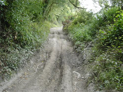
Lynchpin Lane. One of its better days. 746
The damage to these unpaved lanes is caused by the passage of recreational off-road FWD vehicles creating deep ruts and the beginnings of modern sunken lanes, can be seen all too clearly in this lane and the lane that links Priory Farm to Candovers. (See Wick Wood/Coombe Wood).
Adderhood and Outshott Hangers (749325 to 760325) Immediately south of Sotherington Lane is Burhunt Farm, again surrounded by commercial apple orchards, extending south to the Greensand scarps of the Adderhood and Outshott Hangers. Below the scarps is a hidden river valley screened from view by trees along its boundary. The steep U shaped sides to the principal valley that runs west to east is the result of peri-glacial action and post glacial erosion.
The valley itself dwarfs the small Adderhood Stream that runs through it, feeding two ponds; one a small reservoir. This is a very peaceful and scenically attractive area lying on the Selborne parish boundary with Empshott and Bradshott.
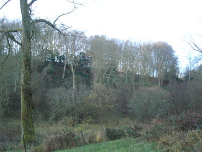
In the Adderhood Valley. 727
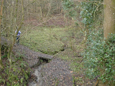
The small Adderhood Stream. 721
Access to the area is via a lay-by on the B3006 (749335). The narrow path travels east on the northern bank of the stream that lies deep below, piped under the road from its source under Noar Hill. The path picks its way through thorny scrub and, although not heavily used, it is narrow and muddy. Little sun can reach the path owing to the high wooded slopes of the hangers on each side. Along its length the main stream is joined by several small tributaries, each in their own steep-sided valley. When the valley opens out (755335) it has a relatively broad, flat flood plain base in which the stream forms two ponds, one significantly larger than the other. The Hangers are clothed with stands of pine (Hemlock Tsuga), and areas of beech, ash and elm, with silver birch and isolated oaks and alder by the stream. By the second pond, at 757336, the path branches three ways: north to join Sotherington Lane; east towards Bradshott Wood; and south across the stream to join Bradshott Lane near Bradshott Hall.
The valley is enclosed on all sides by woodland that forms a series of Hangers and, at its margin, provides a linear boundary for fields on the higher ground, principally the apple orchards of Blackmoor Estate.The valley is very quiet away from the B3006 to the west and is sheltered by the high slopes on each side and by subsidiary valleys that act as wind breaks. Where the sun reaches the valley floor, the dappled shade and leaf colour offer an attractive combination. There is a very real sense of peace and solitude in the valley. Buzzards are seen overhead and pheasants run through the undergrowth. A small herd of roe deer was seen clambering up the sides of the hanger and along the valley ridge. This “secret valley” is a delightful spot; off the beaten track but close to Selborne Village and part of a circular walk that takes in a section of Hangers Way and the edge of Noar Hill, but seemingly seldom used. There is little sign that the woodland is managed to any extent and no effort has been made to clear the large areas of bramble. The entrance from the lay-by is unobtrusive and unattractive, littered with dropped rubbish by car and van owners. Most visitors stopping at the lay-by will be unaware of the attractions of the later sections of the valley and are unlikely to go more than a few yards from the B3006.
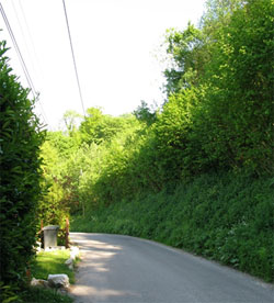
Squiresfield Hanger. 791
Bradshott Lane (754320) is a country lane at the extreme south of the area, linking the B3006 with the Blackmoor end of Sotherington Lane. From the B3006 the lane twists east, being initially hedged on the northern side and fenced to the south, through flat fields with open views north and south, but restricted by the continuous turns to the east. The road has a sharp turn to the left as it loops around the southern point of Outshott Hanger to the north. There is a dwelling at the turn and immediately the countryside changes to have extremely high hedges, backed by mature copper beeches. After a short straight stretch, with an apple field to the north, the road turns sharply right and runs along, cutting into the side of the northern edge of Squiresfield Hanger with a 20m rise to the south, and a drop to the north of approximately 25m where the first of the cluster of houses lies below. The road at this point drops passing a converted oast house, and eventually the driveway dropping away north to Bradshott Hall.
The view to the north, through the hedge is varied and beautiful, mainly across the valley, with more apple fields to Outshott Hanger and Bradshott Wood. To the northeast the view is long, past Oakhanger and Blackmoor. After the houses the road is wooded as it drops down to a sharp left turn to the north, across the Adderhood stream, with a beautiful timber framed thatched cottage at Brockbridge Farm. The area is degraded by farm buildings that are clearly not in use, and look to be in need of repair or demolition. The lane runs on north for 300m to meet Sotherington Lane. The traffic experienced was very light, but as with the neighbouring lanes to the north, there are narrow points and passing places are needed. Most of the surfaces are good, which suggests less intensive heavy agricultural traffic.
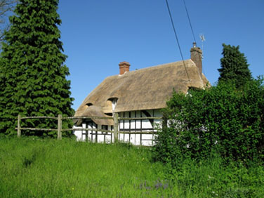
The cottage at Brockbridge. 800
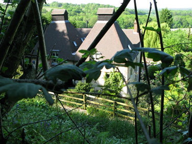
The view north past Bradshott Hall to Outshott Hanger and beyond. 794